MyTopo
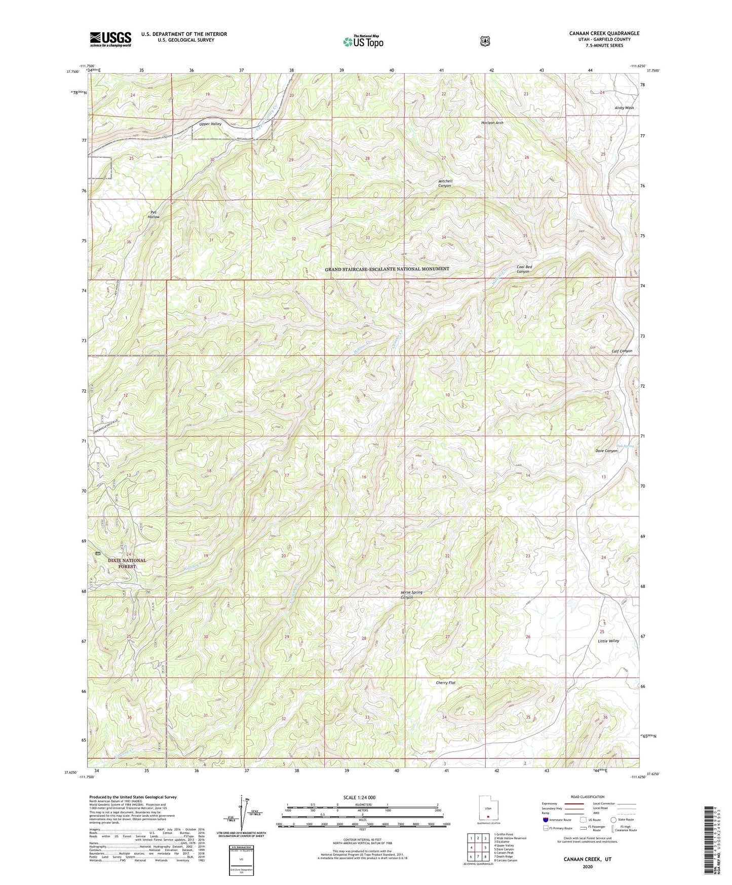
Canaan Creek Utah US Topo Map
Couldn't load pickup availability
Also explore the Canaan Creek Forest Service Topo of this same quad for updated USFS data
2023 topographic map quadrangle Canaan Creek in the state of Utah. Scale: 1:24000. Based on the newly updated USGS 7.5' US Topo map series, this map is in the following counties: Garfield. The map contains contour data, water features, and other items you are used to seeing on USGS maps, but also has updated roads and other features. This is the next generation of topographic maps. Printed on high-quality waterproof paper with UV fade-resistant inks.
Quads adjacent to this one:
West: Upper Valley
Northwest: Griffin Point
North: Wide Hollow Reservoir
Northeast: Escalante
East: Dave Canyon
Southeast: Carcass Canyon
South: Death Ridge
Southwest: Canaan Peak
This map covers the same area as the classic USGS quad with code o37111f6.
Contains the following named places: Calf Canyon, Canaan Creek, Cherry Flat, Coal Bed Canyon, Dave Canyon, Horizon Arch, Horse Spring Canyon, Little Valley, Little Valley Wash, Mitchell Canyon, Oak Spring, Pet Hollow, Trap Canyon Wash, Willow Creek