MyTopo
Cass Creek Peak Utah US Topo Map
Couldn't load pickup availability
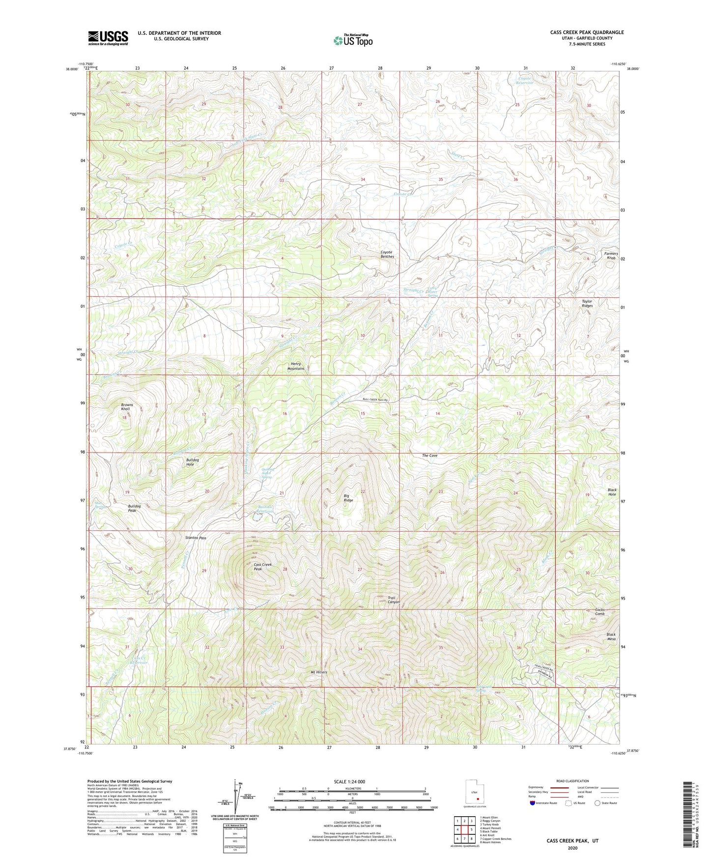
2020 topographic map quadrangle Cass Creek Peak in the state of Utah. Scale: 1:24000. Based on the newly updated USGS 7.5' US Topo map series, this map is in the following counties: Garfield. The map contains contour data, water features, and other items you are used to seeing on USGS maps, but also has updated roads and other features. This is the next generation of topographic maps. Printed on high-quality waterproof paper with UV fade-resistant inks.
Quads adjacent to this one:
West: Mount Pennell
Northwest: Mount Ellen
North: Raggy Canyon
Northeast: Turkey Knob
East: Black Table
Southeast: Mount Holmes
South: Copper Creek Benches
Southwest: Ant Knoll
Contains the following named places: Bastian Reservoir, Benson Creek, Big Ridge, Black Hole, Black Mesa, Browns Creek, Browns Knoll, Bulldog Creek, Bulldog Hole, Bulldog Peak, Carry Water Spring, Cass Creek, Cass Creek Peak, Cass Creek Reservoir, Cocks Comb, Coyote Benches, Coyote Creek, Coyote Reservoir, East Garfield Division, Farmers Knob, Gold Creek Spring, Henry Mountains, Left Fork Slate Creek, Mount Hillers, Mud Spring, Quaking Aspen Creek, Quaking Aspen Spring, Slate Creek, Stanton Pass, Straight Creek, Taylor Ridges, The Cove