MyTopo
Mount Ellen Utah US Topo Map
Couldn't load pickup availability
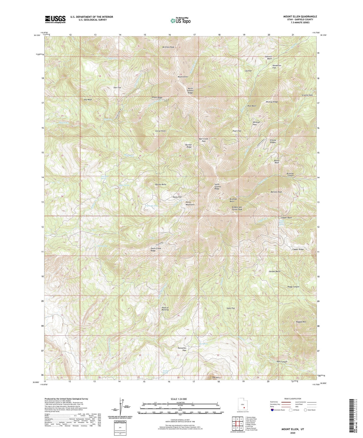
2023 topographic map quadrangle Mount Ellen in the state of Utah. Scale: 1:24000. Based on the newly updated USGS 7.5' US Topo map series, this map is in the following counties: Garfield. The map contains contour data, water features, and other items you are used to seeing on USGS maps, but also has updated roads and other features. This is the next generation of topographic maps. Printed on high-quality waterproof paper with UV fade-resistant inks.
Quads adjacent to this one:
West: Steele Butte
Northwest: Stevens Mesa
North: Dry Lakes Peak
Northeast: Bull Mountain
East: Raggy Canyon
Southeast: Cass Creek Peak
South: Mount Pennell
Southwest: Cave Flat
This map covers the same area as the classic USGS quad with code o38110a7.
Contains the following named places: Airplane Spring, Bartons Peak, Birch Spring, Blue Basin, Box Spring, Bromide Basin, Bromide Canyon, Bromide Mine, Bull Creek Pass, Burned Ridge, Copper Basin, Copper Basin Spring, Copper Ridge, Corral Point, Dandelion Flat, Dark Canyon, Desert Overlook, Dry Lake Flat, Durfey Butte, Garden Basin, Granite Hole, Granite Ridges, Head of Bullfrog, Kimble and Turner Peak, Log Flat, Lonesome Beaver Campground, McClellan Spring, McMillan Springs Campground, Mount Ellen, Mount Ellen Creek, Mount Ellen Peak, Nasty Flat, North Fork Pistol Creek, North Fork South Creek, North Summit Ridge, Pearl Flat, Pennellen Pass, Pistol Creek, Pistol Ridge, Ragged Mountain, Raggy Draws, Sawmill Basin, Slate Flat, South Creek Ridge, South Fork Pistol Creek, South Summit Ridge, Star Flat, Wickiup Pass, Wickiup Ridge, Willow Creek, Willow Spring