MyTopo
Cedar City NW Utah US Topo Map
Couldn't load pickup availability
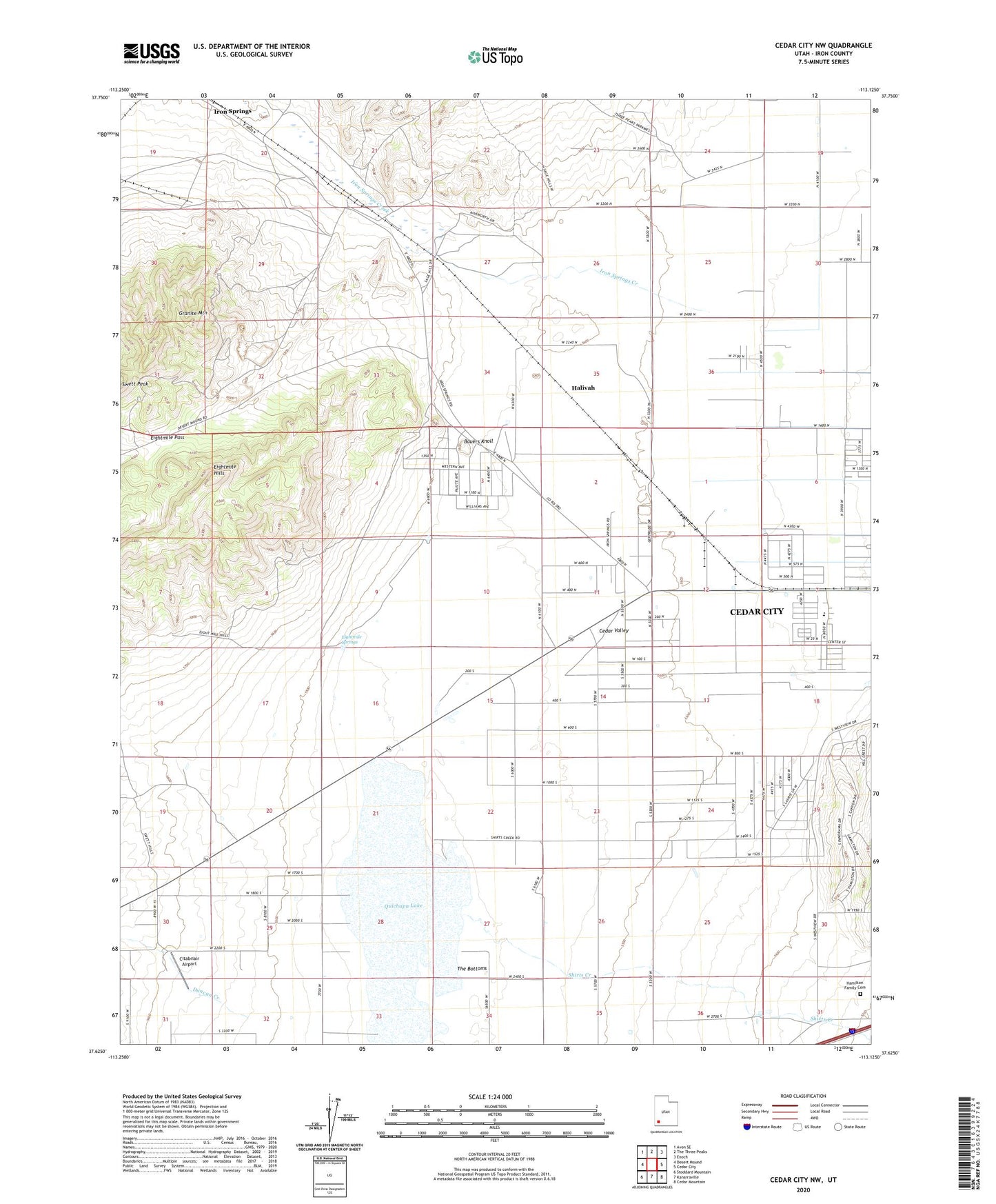
2020 topographic map quadrangle Cedar City NW in the state of Utah. Scale: 1:24000. Based on the newly updated USGS 7.5' US Topo map series, this map is in the following counties: Iron. The map contains contour data, water features, and other items you are used to seeing on USGS maps, but also has updated roads and other features. This is the next generation of topographic maps. Printed on high-quality waterproof paper with UV fade-resistant inks.
Quads adjacent to this one:
West: Desert Mound
Northwest: Avon SE
North: The Three Peaks
Northeast: Enoch
East: Cedar City
Southeast: Cedar Mountain
South: Kanarraville
Southwest: Stoddard Mountain
Contains the following named places: Armstrong Mine, Bauers Knoll, Citabriair Airport, Duncan Creek, East Pioche Mine, Eightmile Hills, Eightmile Pass, Eightmile Springs, Granite Mountain, Great Western Mine, Halivah, Hamilton Family Cemetery, Iron Springs, KSUB-AM (Cedar City), Lindsay Hill Mine, Quichapa Lake, Shirts Creek, Smith Mine, The Bottoms, Vermillion Mine, West Pioche Mine