MyTopo
Enoch Utah US Topo Map
Couldn't load pickup availability
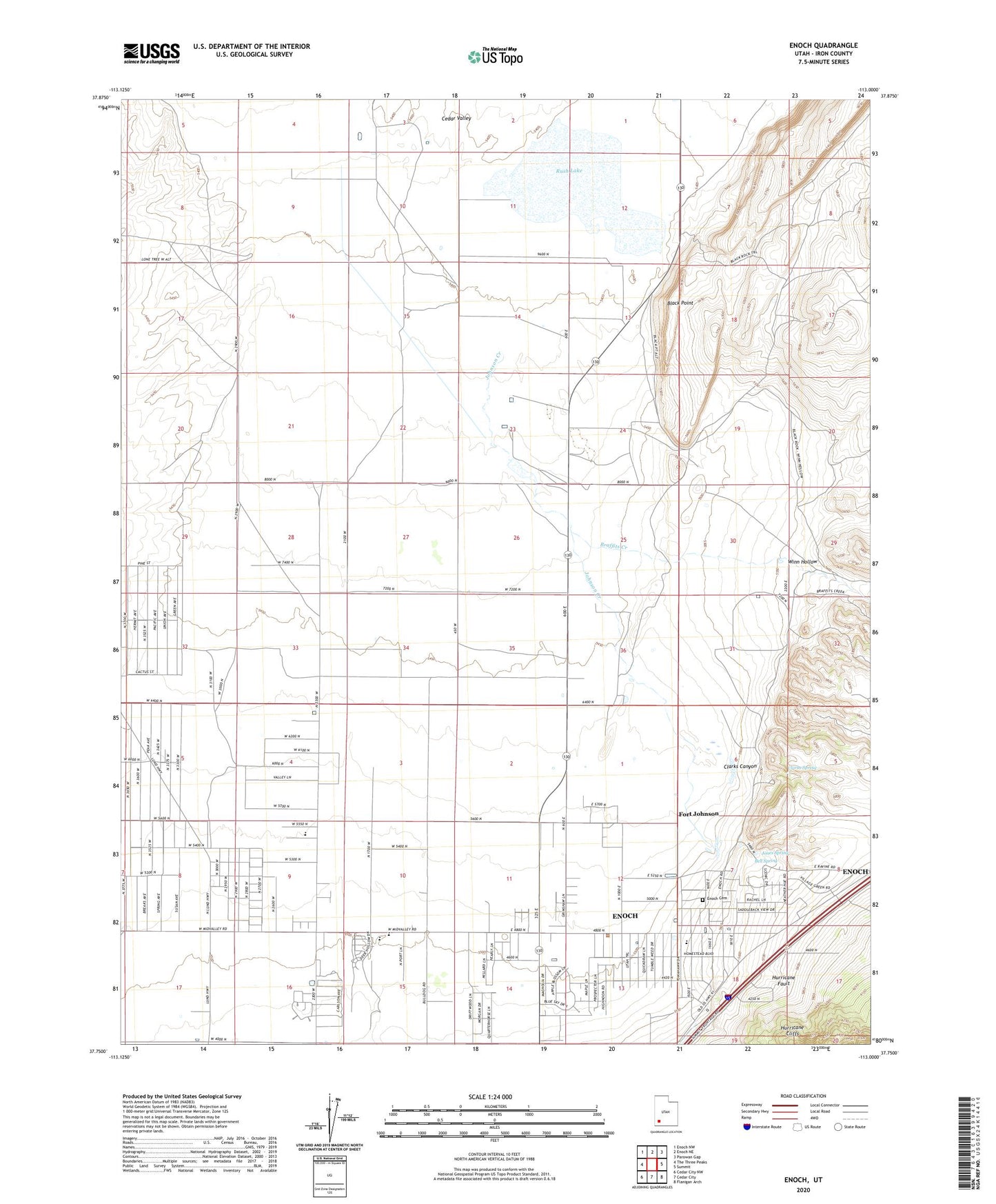
2023 topographic map quadrangle Enoch in the state of Utah. Scale: 1:24000. Based on the newly updated USGS 7.5' US Topo map series, this map is in the following counties: Iron. The map contains contour data, water features, and other items you are used to seeing on USGS maps, but also has updated roads and other features. This is the next generation of topographic maps. Printed on high-quality waterproof paper with UV fade-resistant inks.
Quads adjacent to this one:
West: The Three Peaks
Northwest: Enoch NW
North: Enoch NE
Northeast: Parowan Gap
East: Summit
Southeast: Flanigan Arch
South: Cedar City
Southwest: Cedar City NW
This map covers the same area as the classic USGS quad with code o37113g1.
Contains the following named places: Adams Ranch, Bell Spring, Black Point, Braffits Creek, Cedar City Upland State Game Sanctuary, Cedar Valley, City of Enoch, Clark Airport, Clark Ranch, Clarks Canyon, Clarks Spring, Enoch, Enoch Cemetery, Enoch City Police Department, Enoch Elementary School, Fort Johnson, Jehovahs Witnesses Cedar City Congregation, Johnson Creek, Jones Spring, KBRE-AM (Cedar City), Leigh Farm, Lone Tree, North Spring Reservoir, Rush Lake, Stevensville, The Church of Jesus Christ of Latter Day Saints, Valley Bible Church, Winn Hollow, ZIP Code: 84721