MyTopo
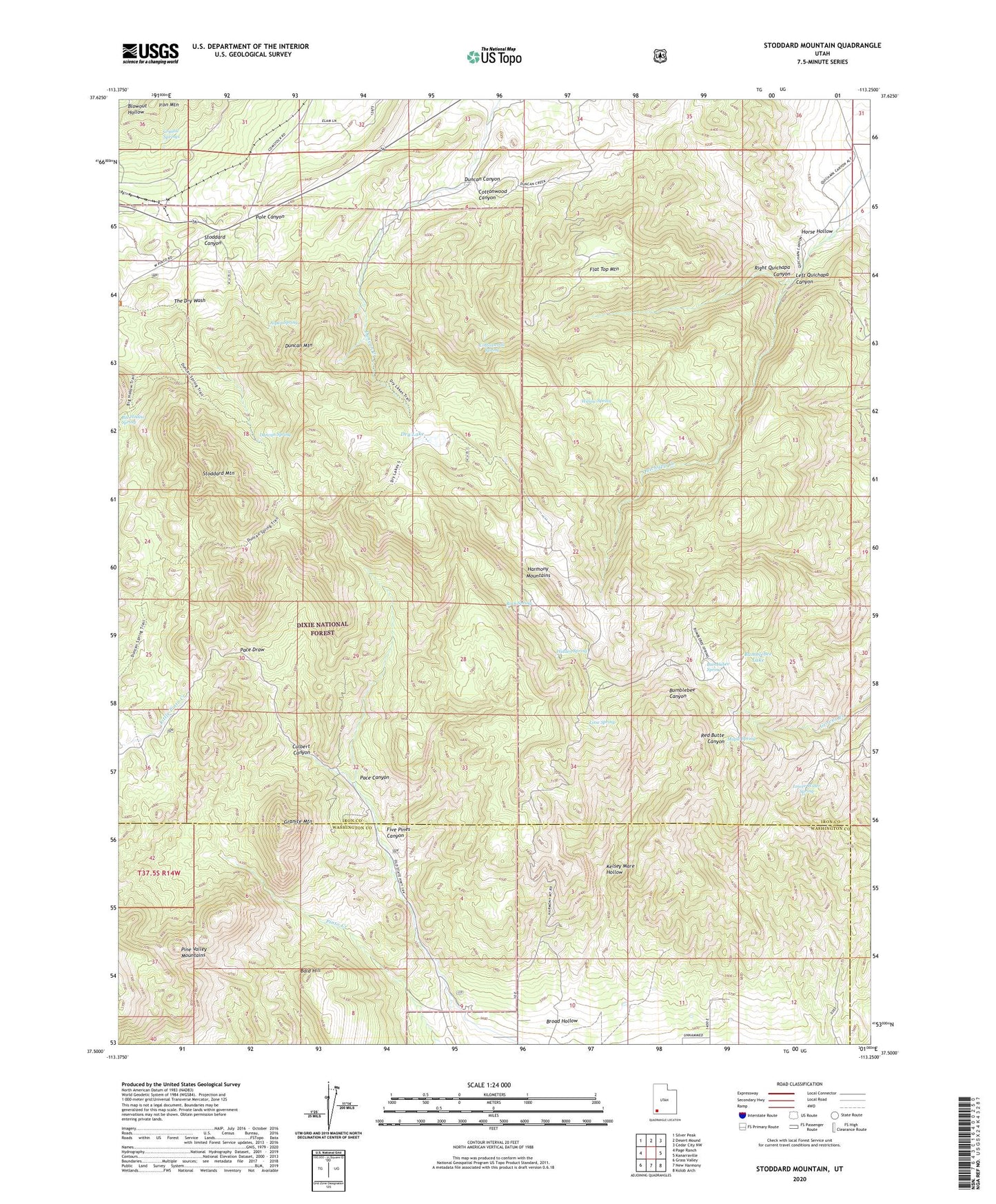
Stoddard Mountain Utah US Topo Map
Couldn't load pickup availability
Also explore the Stoddard Mountain Forest Service Topo of this same quad for updated USFS data
2023 topographic map quadrangle Stoddard Mountain in the state of Utah. Scale: 1:24000. Based on the newly updated USGS 7.5' US Topo map series, this map is in the following counties: Iron, Washington. The map contains contour data, water features, and other items you are used to seeing on USGS maps, but also has updated roads and other features. This is the next generation of topographic maps. Printed on high-quality waterproof paper with UV fade-resistant inks.
Quads adjacent to this one:
West: Page Ranch
Northwest: Silver Peak
North: Desert Mound
Northeast: Cedar City NW
East: Kanarraville
Southeast: Kolob Arch
South: New Harmony
Southwest: Grass Valley
This map covers the same area as the classic USGS quad with code o37113e3.
Contains the following named places: Aspen Spring, Bald Hill, Broad Hollow, Bumblebee Lake, Bumblebee Spring, Cottonwood Canyon, Cottonwood Spring, Crystal Springs, Culbert Canyon, Dry Lake, Dry Lakes Trail, Duncan Canyon, Duncan Canyon Trail, Duncan Mountain, Duncan Spring, Five Pines Canyon, Flat Top Mountain, Granite Mountain, Harmony Mountains, Hidden Spring, Horse Hollow, Iron Mountain Wye, Kelsey Deer Camp, Kelsey Mare Hollow, Left Quichapa Canyon, Lime Spring, Lower Water Spring, Maple Spring, Pace Canyon, Pole Canyon, Right Quichapa Canyon, Rock Spring, Stoddard Canyon, Stoddard Mountain, Willow Spring