MyTopo
Cedar Mountain Utah US Topo Map
Couldn't load pickup availability
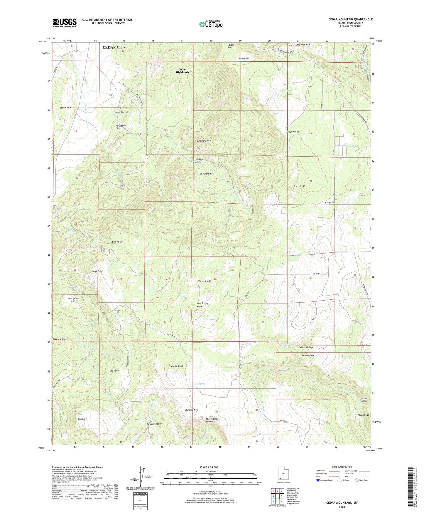
2023 topographic map quadrangle Cedar Mountain in the state of Utah. Scale: 1:24000. Based on the newly updated USGS 7.5' US Topo map series, this map is in the following counties: Iron. The map contains contour data, water features, and other items you are used to seeing on USGS maps, but also has updated roads and other features. This is the next generation of topographic maps. Printed on high-quality waterproof paper with UV fade-resistant inks.
Quads adjacent to this one:
West: Kanarraville
Northwest: Cedar City NW
North: Cedar City
Northeast: Flanigan Arch
East: Webster Flat
Southeast: Cogswell Point
South: Kolob Reservoir
Southwest: Kolob Arch
This map covers the same area as the classic USGS quad with code o37113e1.
Contains the following named places: Bean Hill, Blue Valley, Cabbage Valley, Cedar City Corp Storage Dam, Cedar City Corp Storage Reservoir, Cooks Spring, Co-op Flat, Co-op Knoll, Co-op Spring, Day Spring, Death Hollow, Graff Point, Hicks Creek, Horse Hollow, Kanarra Mountain, Lee Point, Long Flat, Oak Spring, Oak Spring Flat, Pine Spring, Pine Spring Knoll, Pryor Knoll, Reeves Creek, Shirts Canyon, Shiver Creek, Spanish Hollow, Square Mountain, Sugarloaf Mountain, The Pyramids, Three Knolls, Three Knolls Summit, Tucker Coal Mine, Woods Hollow