MyTopo
Chandler Falls Utah US Topo Map
Couldn't load pickup availability
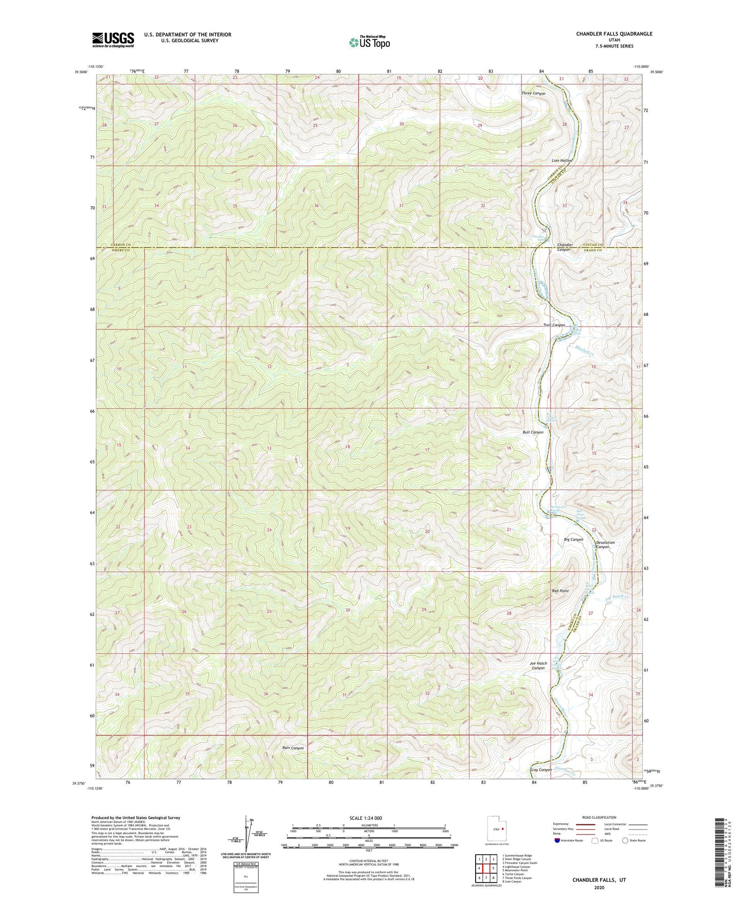
2020 topographic map quadrangle Chandler Falls in the state of Utah. Scale: 1:24000. Based on the newly updated USGS 7.5' US Topo map series, this map is in the following counties: Emery, Carbon, Grand, Uintah. The map contains contour data, water features, and other items you are used to seeing on USGS maps, but also has updated roads and other features. This is the next generation of topographic maps. Printed on high-quality waterproof paper with UV fade-resistant inks.
Quads adjacent to this one:
West: Lighthouse Canyon
Northwest: Summerhouse Ridge
North: Steer Ridge Canyon
Northeast: Firewater Canyon South
East: Moonwater Point
Southeast: Lion Canyon
South: Three Fords Canyon
Southwest: Turtle Canyon
Contains the following named places: Big Canyon, Bluebell Creek, Bull Canyon, Bull Canyon Rapids, Chandler Canyon, Chandler Falls, Desolation Canyon, Joe Hatch Canyon, Joe Hutch Canyon Rapids, Joe Hutch Creek, Joe Hutch Creek Rapids, Lion Hollow, McPherson Ranch, Moonwater Rapids, Red Point, Red Point Rapids, Three Canyon, Trail Canyon, Trail Canyon Rapids