MyTopo
Moonwater Point Utah US Topo Map
Couldn't load pickup availability
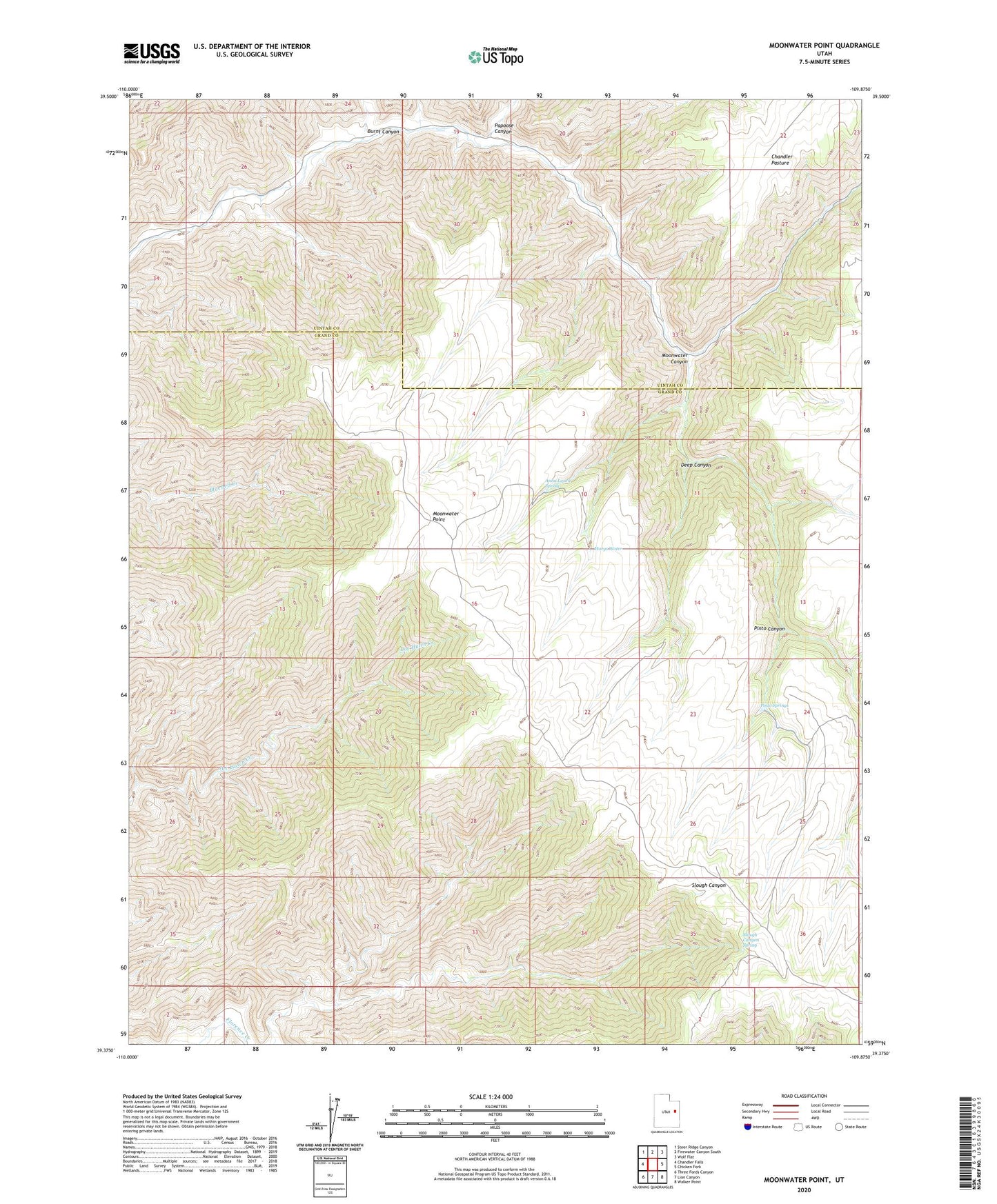
2023 topographic map quadrangle Moonwater Point in the state of Utah. Scale: 1:24000. Based on the newly updated USGS 7.5' US Topo map series, this map is in the following counties: Grand, Uintah. The map contains contour data, water features, and other items you are used to seeing on USGS maps, but also has updated roads and other features. This is the next generation of topographic maps. Printed on high-quality waterproof paper with UV fade-resistant inks.
Quads adjacent to this one:
West: Chandler Falls
Northwest: Steer Ridge Canyon
North: Firewater Canyon South
Northeast: Wolf Flat
East: Chicken Fork
Southeast: Walker Point
South: Lion Canyon
Southwest: Three Fords Canyon
This map covers the same area as the classic USGS quad with code o39109d8.
Contains the following named places: Anna Laura Spring, Burnt Canyon, Chandler Pasture, Deep Canyon, Marys Water, Moonwater Canyon, Moonwater Point, Papoose Canyon, Pinto Canyon, Pinto Springs, Slough Canyon Spring