MyTopo
Summerhouse Ridge Utah US Topo Map
Couldn't load pickup availability
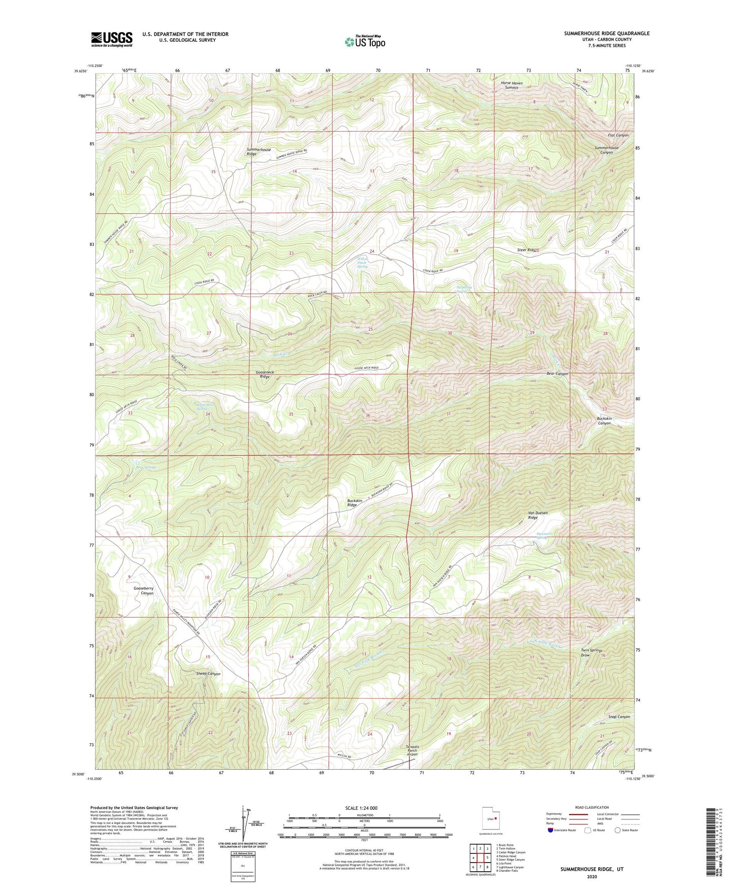
2023 topographic map quadrangle Summerhouse Ridge in the state of Utah. Scale: 1:24000. Based on the newly updated USGS 7.5' US Topo map series, this map is in the following counties: Carbon. The map contains contour data, water features, and other items you are used to seeing on USGS maps, but also has updated roads and other features. This is the next generation of topographic maps. Printed on high-quality waterproof paper with UV fade-resistant inks.
Quads adjacent to this one:
West: Patmos Head
Northwest: Bruin Point
North: Twin Hollow
Northeast: Cedar Ridge Canyon
East: Steer Ridge Canyon
Southeast: Chandler Falls
South: Lighthouse Canyon
Southwest: Lila Point
This map covers the same area as the classic USGS quad with code o39110e2.
Contains the following named places: Bear Canyon, Bear Springs, Buckskin Canyon, Buckskin Ridge, Downard Spring, Gooseneck Ridge, Spradling Spring, Steer Ridge, Summerhouse Canyon, Summerhouse Ridge, Tavapats Ranch Airport, Twin Springs Draw, Van Duesen Ridge, White Bear Spring, Willow Patch Spring