MyTopo
Lighthouse Canyon Utah US Topo Map
Couldn't load pickup availability
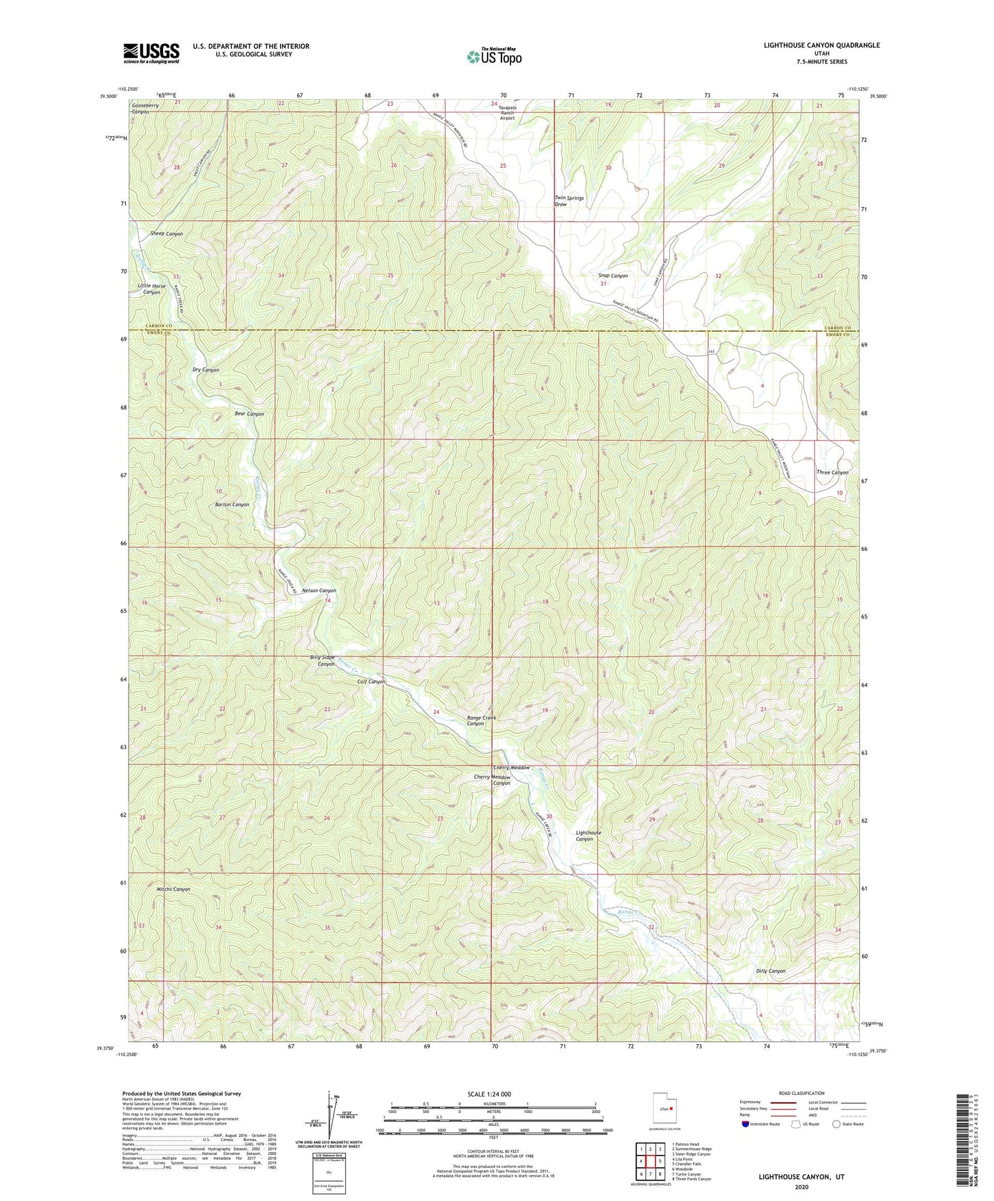
2023 topographic map quadrangle Lighthouse Canyon in the state of Utah. Scale: 1:24000. Based on the newly updated USGS 7.5' US Topo map series, this map is in the following counties: Emery, Carbon. The map contains contour data, water features, and other items you are used to seeing on USGS maps, but also has updated roads and other features. This is the next generation of topographic maps. Printed on high-quality waterproof paper with UV fade-resistant inks.
Quads adjacent to this one:
West: Lila Point
Northwest: Patmos Head
North: Summerhouse Ridge
Northeast: Steer Ridge Canyon
East: Chandler Falls
Southeast: Three Fords Canyon
South: Turtle Canyon
Southwest: Woodside
This map covers the same area as the classic USGS quad with code o39110d2.
Contains the following named places: Barton Canyon, Bear Canyon, Billy Slope Canyon, Calf Canyon, Cherry Meadow, Cherry Meadow Canyon, Dilly Canyon, Dry Canyon, Lighthouse Canyon, Little Horse Canyon, Nelson Canyon, Sheep Canyon