MyTopo
Cisco SW Utah US Topo Map
Couldn't load pickup availability
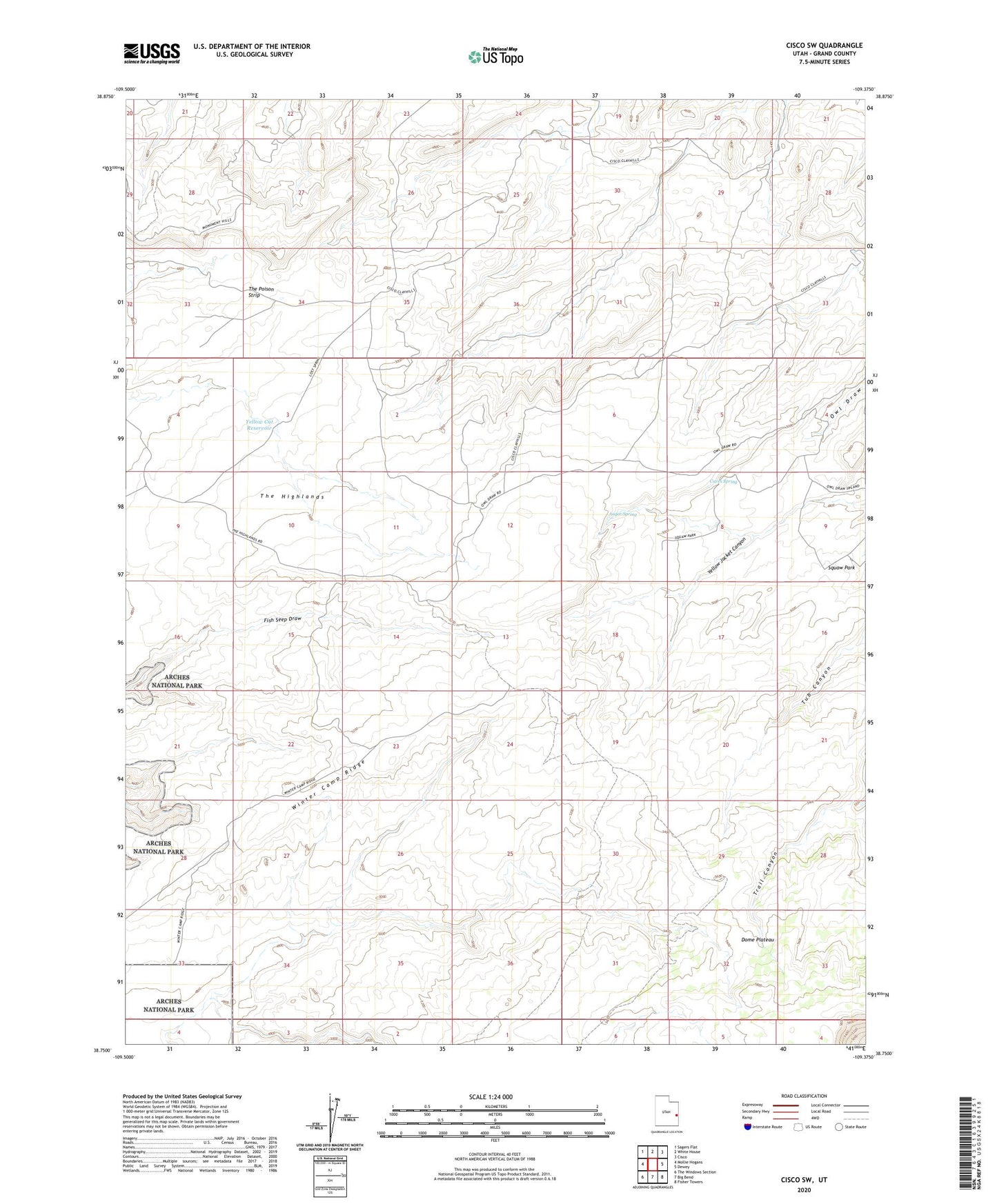
2020 topographic map quadrangle Cisco SW in the state of Utah. Scale: 1:24000. Based on the newly updated USGS 7.5' US Topo map series, this map is in the following counties: Grand. The map contains contour data, water features, and other items you are used to seeing on USGS maps, but also has updated roads and other features. This is the next generation of topographic maps. Printed on high-quality waterproof paper with UV fade-resistant inks.
Quads adjacent to this one:
West: Mollie Hogans
Northwest: Sagers Flat
North: White House
Northeast: Cisco
East: Dewey
Southeast: Fisher Towers
South: Big Bend
Southwest: The Windows Section
Contains the following named places: Auger Spring, Cactus Rat Mine, Caves Spring, Dome Plateau, Squaw Park, The Highlands, The Poison Strip, Winter Camp Ridge, Yellow Cat Reservoir