MyTopo
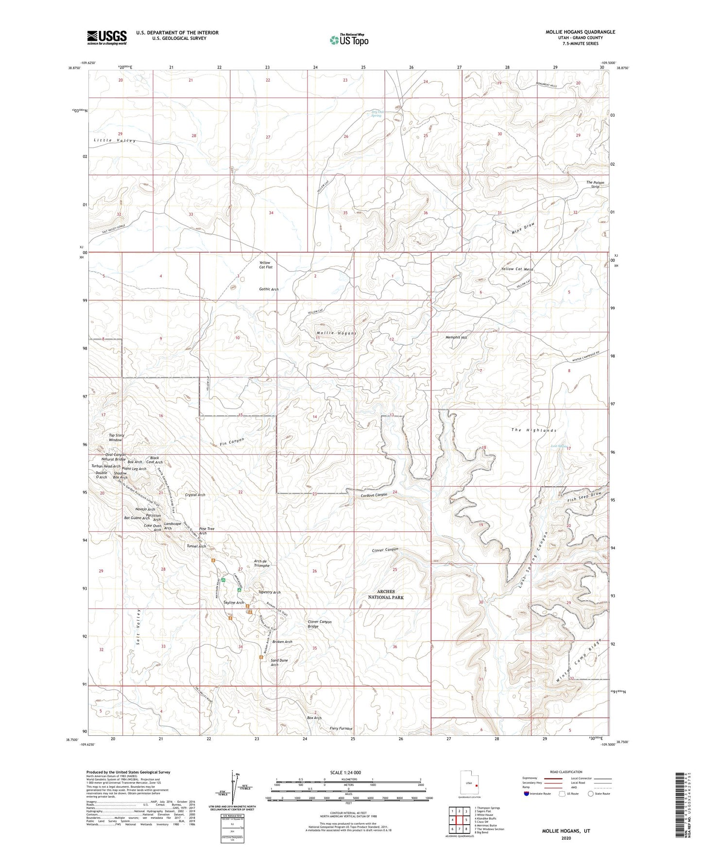
Mollie Hogans Utah US Topo Map
Couldn't load pickup availability
2023 topographic map quadrangle Mollie Hogans in the state of Utah. Scale: 1:24000. Based on the newly updated USGS 7.5' US Topo map series, this map is in the following counties: Grand. The map contains contour data, water features, and other items you are used to seeing on USGS maps, but also has updated roads and other features. This is the next generation of topographic maps. Printed on high-quality waterproof paper with UV fade-resistant inks.
Quads adjacent to this one:
West: Klondike Bluffs
Northwest: Thompson Springs
North: Sagers Flat
Northeast: White House
East: Cisco SW
Southeast: Big Bend
South: The Windows Section
Southwest: Merrimac Butte
This map covers the same area as the classic USGS quad with code o38109g5.
Contains the following named places: Agate Wash, Arch de Triumphe, Bat Guano Arch, Black Ape Mine, Black Cave Arch, Blackstone Incline, Box Arch, Broken Arch, Clover Canyon, Clover Canyon Bridge, Coke Oven Arch, Cordova Canyon, Cottonwood Wash, Crystal Arch, Devils Garden, Devils Garden Trailhead, Double O Arch, Dry Oak Spring, Fiery Furnace, Fin Canyon, Fish Seep Draw, Gothic Arch, Johns Incline, Landscape Arch, Lemon Airport, Little Eva Mine, Little Valley, Lost Spring, Lost Spring Canyon, Memphis Hill, Memphis Mines, Mine Draw, Mollie Hogans, Navajo Arch, Oval Canyon Natural Bridge, Parco Mines, Partition Arch, Piano Leg Arch, Pine Tree Arch, Ringtail Mine, Sand Dune Arch, Shadow Box Arch, Skyline Arch, Tapestry Arch, Telluride Mines, The Biscuits, Top Story Window, Tunnel Arch, Turban Head Arch, Wall Arch, Yellow Bird Mine, Yellow Cat Flat, Yellow Cat Mesa, Yellow Cat Wash