MyTopo
Coyote Springs Utah US Topo Map
Couldn't load pickup availability
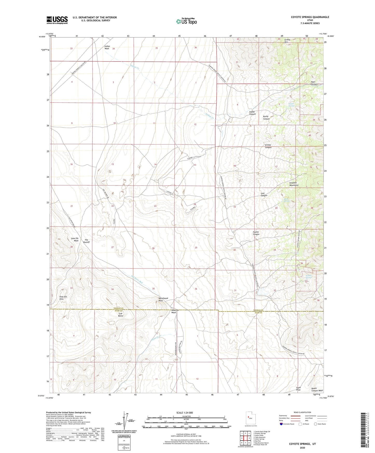
2023 topographic map quadrangle Coyote Springs in the state of Utah. Scale: 1:24000. Based on the newly updated USGS 7.5' US Topo map series, this map is in the following counties: Tooele, Juab. The map contains contour data, water features, and other items you are used to seeing on USGS maps, but also has updated roads and other features. This is the next generation of topographic maps. Printed on high-quality waterproof paper with UV fade-resistant inks.
Quads adjacent to this one:
West: Table Mountain
Northwest: Camels Back Ridge SW
North: Simpson Springs
Northeast: Indian Peaks
East: Indian Springs
Southeast: Erickson Wash SW
South: Keg Mountain Ranch
Southwest: Keg Pass
This map covers the same area as the classic USGS quad with code o39112h7.
Contains the following named places: Burnt Springs, Coyote Springs, Cup Butte, Dead Ox Wash, Footes Canyon, Government Well Number 36, Grassy Canyon, Indian Canyon, Indian Creek, Indian Wash, Lost Canyon, Raul Canyon, Rocky Canyon, Route of Pony Express, Sixmile Springs, Slow Elk Hills, Slow Elk Wash, Snow Plow, The Shutoff, Warehouse Rock