MyTopo
Delle Utah US Topo Map
Couldn't load pickup availability
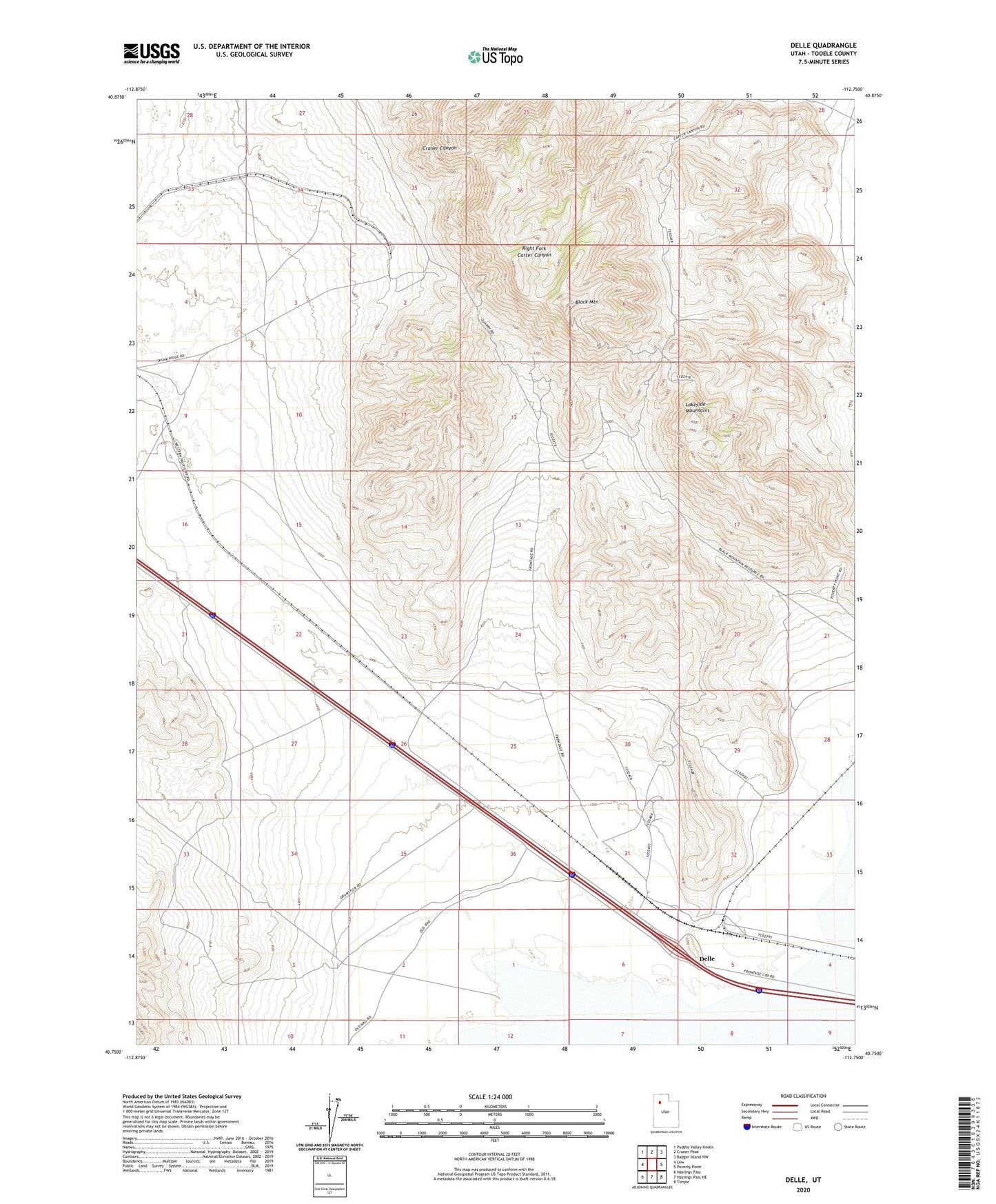
2023 topographic map quadrangle Delle in the state of Utah. Scale: 1:24000. Based on the newly updated USGS 7.5' US Topo map series, this map is in the following counties: Tooele. The map contains contour data, water features, and other items you are used to seeing on USGS maps, but also has updated roads and other features. This is the next generation of topographic maps. Printed on high-quality waterproof paper with UV fade-resistant inks.
Quads adjacent to this one:
West: Low
Northwest: Puddle Valley Knolls
North: Craner Peak
Northeast: Badger Island NW
East: Poverty Point
Southeast: Timpie
South: Hastings Pass NE
Southwest: Hastings Pass
This map covers the same area as the classic USGS quad with code o40112g7.
Contains the following named places: Black Mountain, Delle, Delle Well, Government Well Number 82, Marblehead Plant