
MyTopo
Death Creek Reservoir Utah US Topo Map
Couldn't load pickup availability
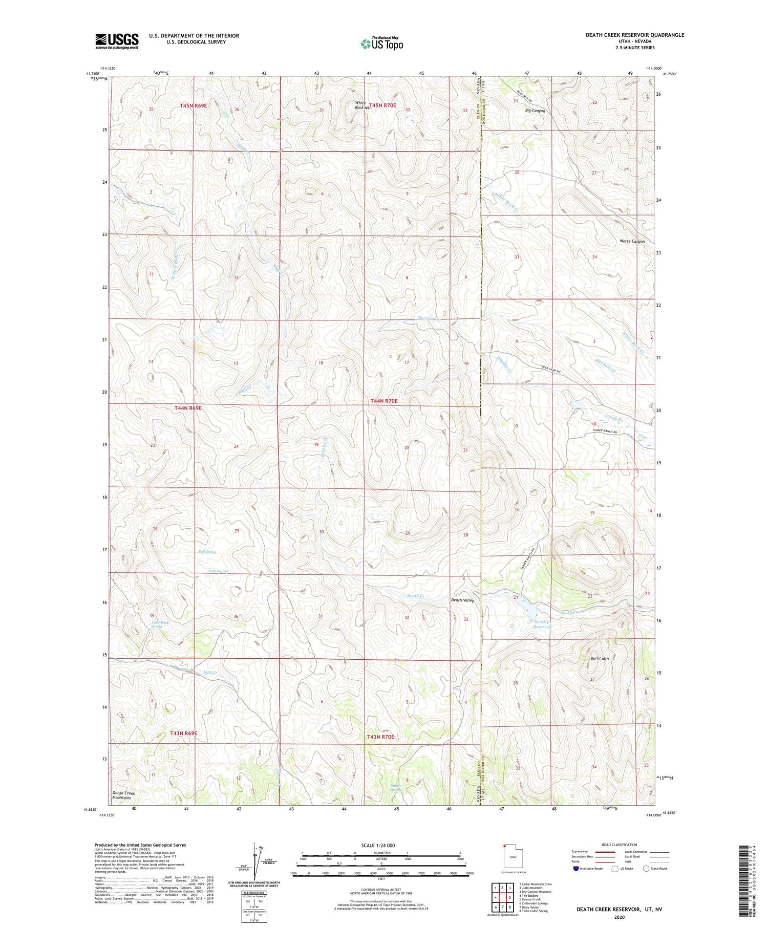
2020 topographic map quadrangle Death Creek Reservoir in the states of Nevada, Utah. Scale: 1:24000. Based on the newly updated USGS 7.5' US Topo map series, this map is in the following counties: Box Elder, Elko. The map contains contour data, water features, and other items you are used to seeing on USGS maps, but also has updated roads and other features. This is the next generation of topographic maps. Printed on high-quality waterproof paper with UV fade-resistant inks.
Quads adjacent to this one:
West: The Baldies
Northwest: Cedar Mountain Draw
North: Judd Mountain
Northeast: Dry Canyon Mountain
East: Grouse Creek
Southeast: Toms Cabin Spring
South: Dairy Valley
Southwest: Crittenden Springs
Contains the following named places: Big Canyon, Bull Spring, Burnt Mountain, Death Creek Reservoir, Death Valley, Dinner Springs, Goose Creek Mountains, Little Rock Spring, Middle Creek, Toro Spring, Vals Camp, White Rock Mountain


