MyTopo
Deep Creek Canyon Utah US Topo Map
Couldn't load pickup availability
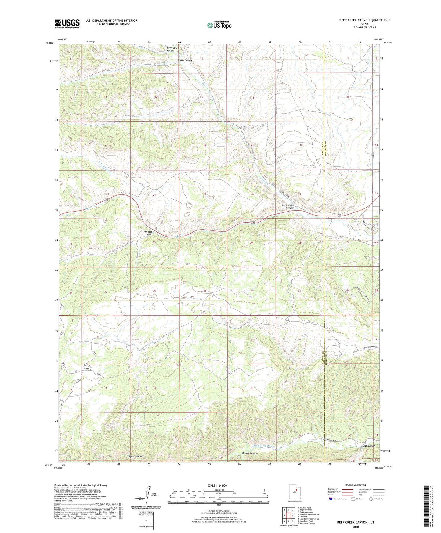
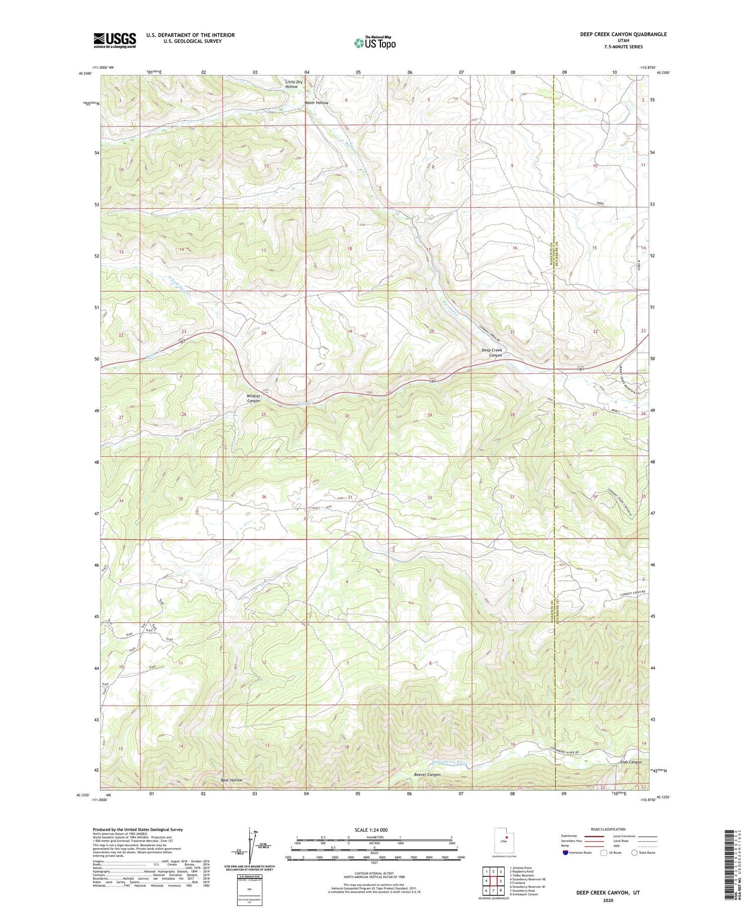
2020 topographic map quadrangle Deep Creek Canyon in the state of Utah. Scale: 1:24000. Based on the newly updated USGS 7.5' US Topo map series, this map is in the following counties: Wasatch, Duchesne. The map contains contour data, water features, and other items you are used to seeing on USGS maps, but also has updated roads and other features. This is the next generation of topographic maps. Printed on high-quality waterproof paper with UV fade-resistant inks.
Quads adjacent to this one:
West: Strawberry Reservoir NE
Northwest: Jimmies Point
North: Raspberry Knoll
Northeast: Tabby Mountain
East: Fruitland
Southeast: Avintaquin Canyon
South: Strawberry Peak
Southwest: Strawberry Reservoir SE
Contains the following named places: Bear Hollow, Beaver Canyon, Currant Creek Wildlife Management Area, Deep Creek, Deep Creek Canyon, Little Dry Hollow, North Fork Deep Creek, Racetrack Campground, Slab Canyon, Water Hollow, Wildcat Canyon, Wildcat Wildlife Management Area