MyTopo
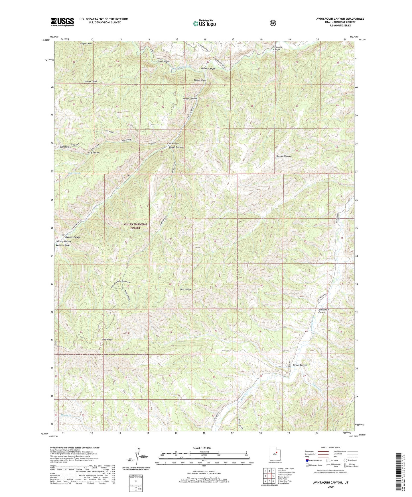
Avintaquin Canyon Utah US Topo Map
Couldn't load pickup availability
Also explore the Avintaquin Canyon Forest Service Topo of this same quad for updated USFS data
2023 topographic map quadrangle Avintaquin Canyon in the state of Utah. Scale: 1:24000. Based on the newly updated USGS 7.5' US Topo map series, this map is in the following counties: Duchesne. The map contains contour data, water features, and other items you are used to seeing on USGS maps, but also has updated roads and other features. This is the next generation of topographic maps. Printed on high-quality waterproof paper with UV fade-resistant inks.
Quads adjacent to this one:
West: Strawberry Peak
Northwest: Deep Creek Canyon
North: Fruitland
Northeast: Strawberry Pinnacles
East: Sams Canyon
Southeast: Jones Hollow
South: Gray Head Peak
Southwest: Flat Ridge
This map covers the same area as the classic USGS quad with code o40110a7.
Contains the following named places: Baum Ranch, Bull Hollow, Bumper Canyon, Calf Hollow, Cow Hollow, Finger Canyon, Grassy Hollow, Jensen Canyon, Long Ridge, Lost Canyon, Peatross Ranch, Poison Creek, Remund Ranch, Rough Canyon, Sagers Spring, Simmons Canyon, Sulfur Draw, Timber Canyon, Timber Point, Water Hollow