MyTopo
Fruitland Utah US Topo Map
Couldn't load pickup availability
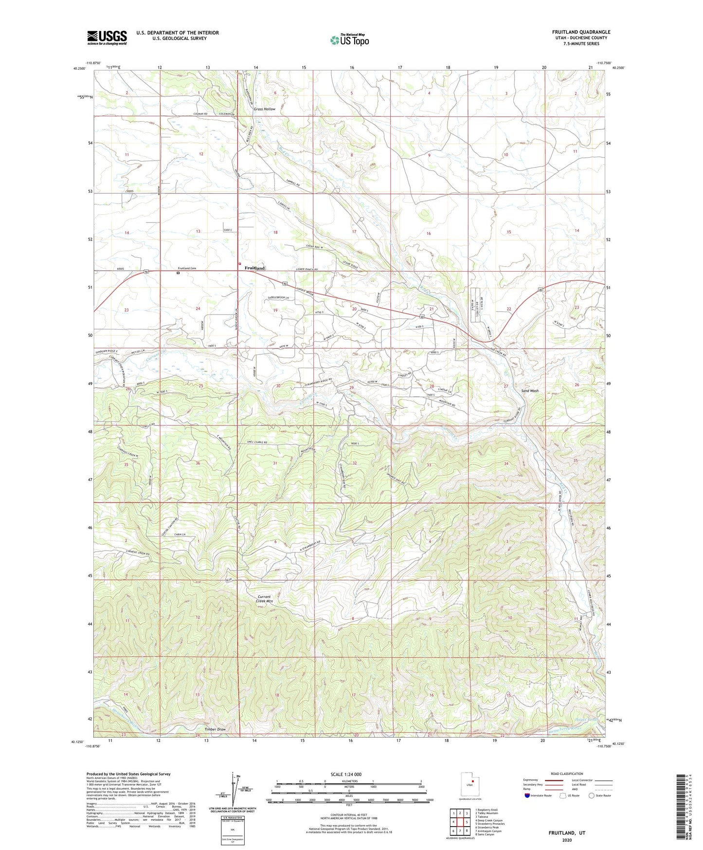
2023 topographic map quadrangle Fruitland in the state of Utah. Scale: 1:24000. Based on the newly updated USGS 7.5' US Topo map series, this map is in the following counties: Duchesne. The map contains contour data, water features, and other items you are used to seeing on USGS maps, but also has updated roads and other features. This is the next generation of topographic maps. Printed on high-quality waterproof paper with UV fade-resistant inks.
Quads adjacent to this one:
West: Deep Creek Canyon
Northwest: Raspberry Knoll
North: Tabby Mountain
Northeast: Tabiona
East: Strawberry Pinnacles
Southeast: Sams Canyon
South: Avintaquin Canyon
Southwest: Strawberry Peak
This map covers the same area as the classic USGS quad with code o40110b7.
Contains the following named places: Currant Creek, Currant Creek Mountain, Fruitland, Fruitland Cemetery, Fruitland Fire Department, Grass Hollow, Hayes Ponds, Sand Wash, The Church of Jesus Christ of Latter Day Saints, Timber Draw, ZIP Code: 84027