MyTopo
Raspberry Knoll Utah US Topo Map
Couldn't load pickup availability
Also explore the Raspberry Knoll Forest Service Topo of this same quad for updated USFS data
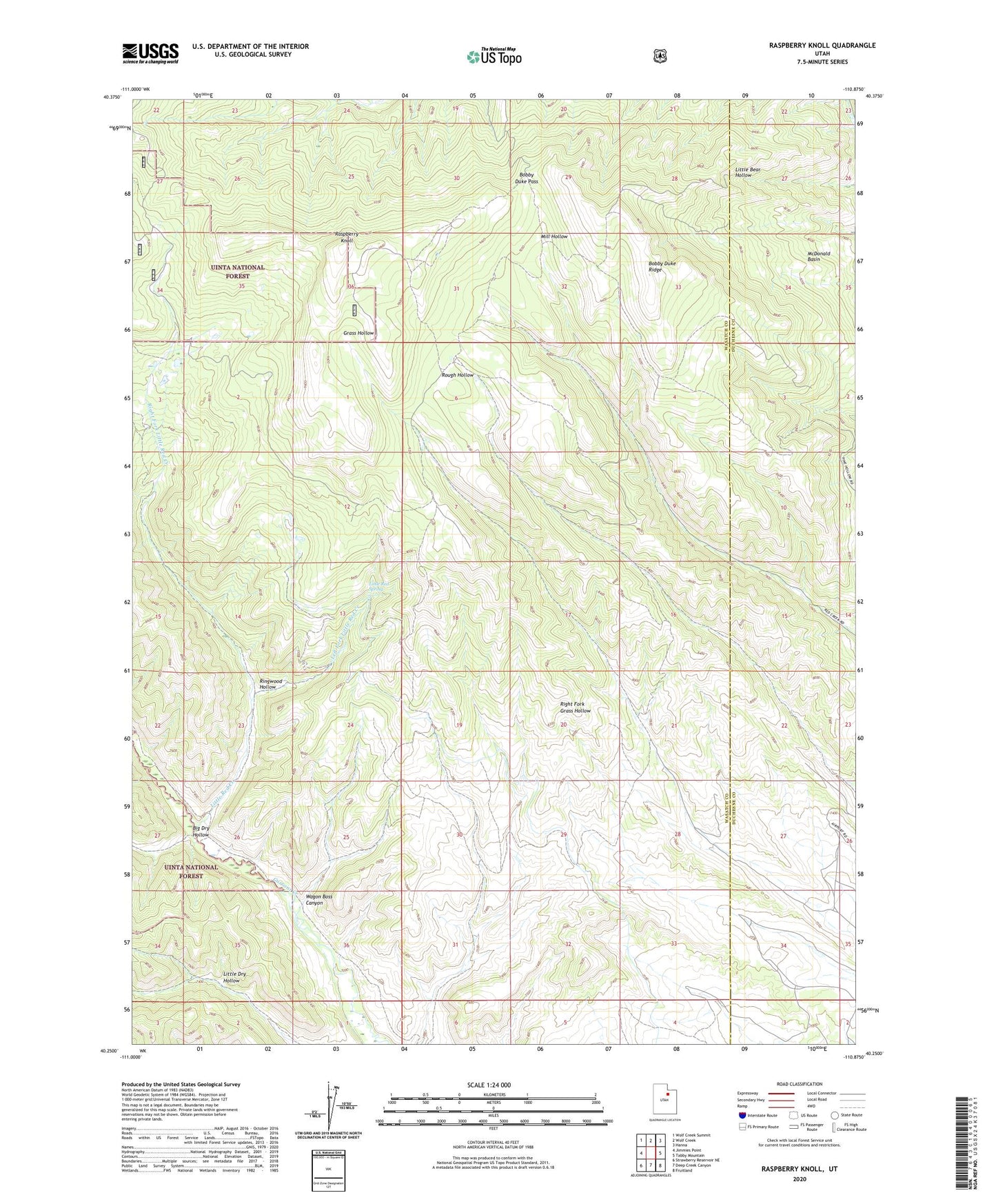
2023 topographic map quadrangle Raspberry Knoll in the state of Utah. Scale: 1:24000. Based on the newly updated USGS 7.5' US Topo map series, this map is in the following counties: Wasatch, Duchesne. The map contains contour data, water features, and other items you are used to seeing on USGS maps, but also has updated roads and other features. This is the next generation of topographic maps. Printed on high-quality waterproof paper with UV fade-resistant inks.
Quads adjacent to this one:
West: Jimmies Point
Northwest: Wolf Creek Summit
North: Wolf Creek
Northeast: Hanna
East: Tabby Mountain
Southeast: Fruitland
South: Deep Creek Canyon
Southwest: Strawberry Reservoir NE
This map covers the same area as the classic USGS quad with code o40110c8.
Contains the following named places: Big Dry Hollow, Bobby Duke Pass, Bobby Duke Ridge, Left Fork Little Red Creek, Little Red Creek, Little Red Spring, McDonald Basin, Raspberry Knoll, Right Fork Little Red Creek, Ringwood Hollow, Wagon Boss Canyon