MyTopo
Desert Mountain Pass Utah US Topo Map
Couldn't load pickup availability
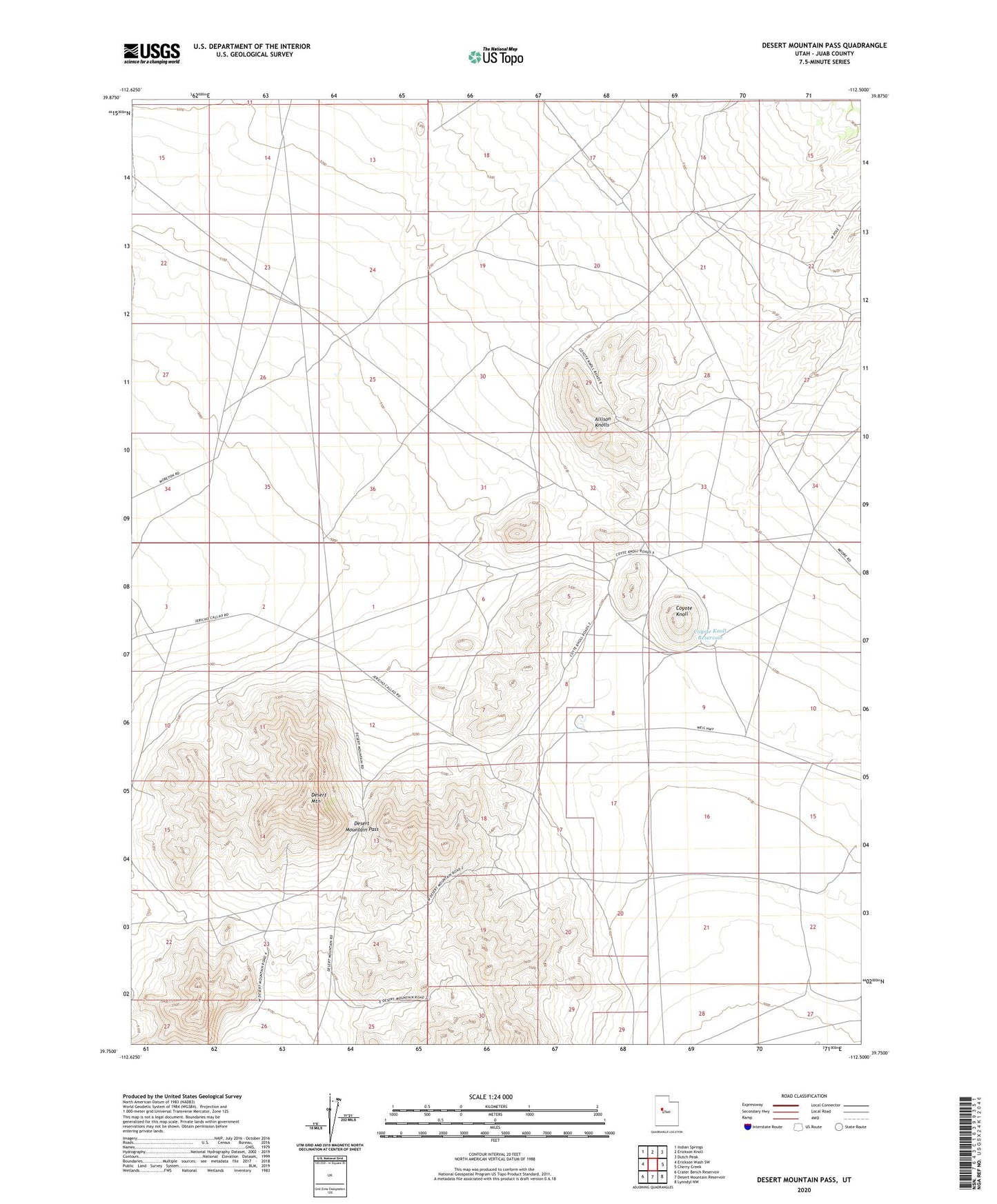
2020 topographic map quadrangle Desert Mountain Pass in the state of Utah. Scale: 1:24000. Based on the newly updated USGS 7.5' US Topo map series, this map is in the following counties: Juab. The map contains contour data, water features, and other items you are used to seeing on USGS maps, but also has updated roads and other features. This is the next generation of topographic maps. Printed on high-quality waterproof paper with UV fade-resistant inks.
Quads adjacent to this one:
West: Erickson Wash SW
Northwest: Indian Springs
North: Erickson Knoll
Northeast: Dutch Peak
East: Cherry Creek
Southeast: Lynndyl NW
South: Desert Mountain Reservoir
Southwest: Crater Bench Reservoir
Contains the following named places: Allison Knolls, Cow Hollow Well, Coyote Knoll, Coyote Knoll Reservoir, Desert Mountain, Desert Mountain Pass