MyTopo
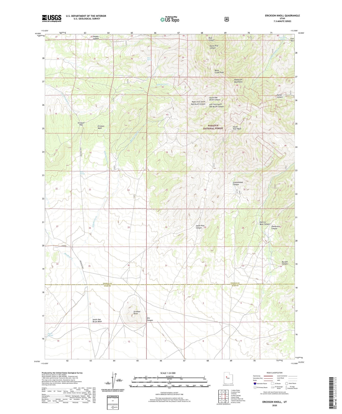
Erickson Knoll Utah US Topo Map
Couldn't load pickup availability
Also explore the Erickson Knoll Forest Service Topo of this same quad for updated USFS data
2023 topographic map quadrangle Erickson Knoll in the state of Utah. Scale: 1:24000. Based on the newly updated USGS 7.5' US Topo map series, this map is in the following counties: Tooele, Juab. The map contains contour data, water features, and other items you are used to seeing on USGS maps, but also has updated roads and other features. This is the next generation of topographic maps. Printed on high-quality waterproof paper with UV fade-resistant inks.
Quads adjacent to this one:
West: Indian Springs
Northwest: Indian Peaks
North: Lookout Pass
Northeast: Vernon
East: Dutch Peak
Southeast: Cherry Creek
South: Desert Mountain Pass
Southwest: Erickson Wash SW
This map covers the same area as the classic USGS quad with code o39112h5.
Contains the following named places: Black Crook Creek, Black Crook Peak, Black Ranch, Black Spring, Burned Canyon, Clinger Mine, Copper Jack Mine, Cottonwood Canyon, Desert Springs, Ekker Ranch, Elderberry Creek, Erickson Knoll, Erickson Pass, Flying Dutchman Mine, Hard to Beat Canyon, Hilltop Mine, Left Fork South Oak Brush Canyon, Lion Hill, Lion Hill Spring, Lower Pine Grove, Meadow Creek, Mud Spring, Right Fork South Oak Brush Canyon, Sheeprock Canyon, South Oak Brush Canyon, South Oak Brush Wash, South Pine Canyon, Upper Pine Grove, Utah Mine, Wright Ranch