MyTopo
Cherry Creek Utah US Topo Map
Couldn't load pickup availability
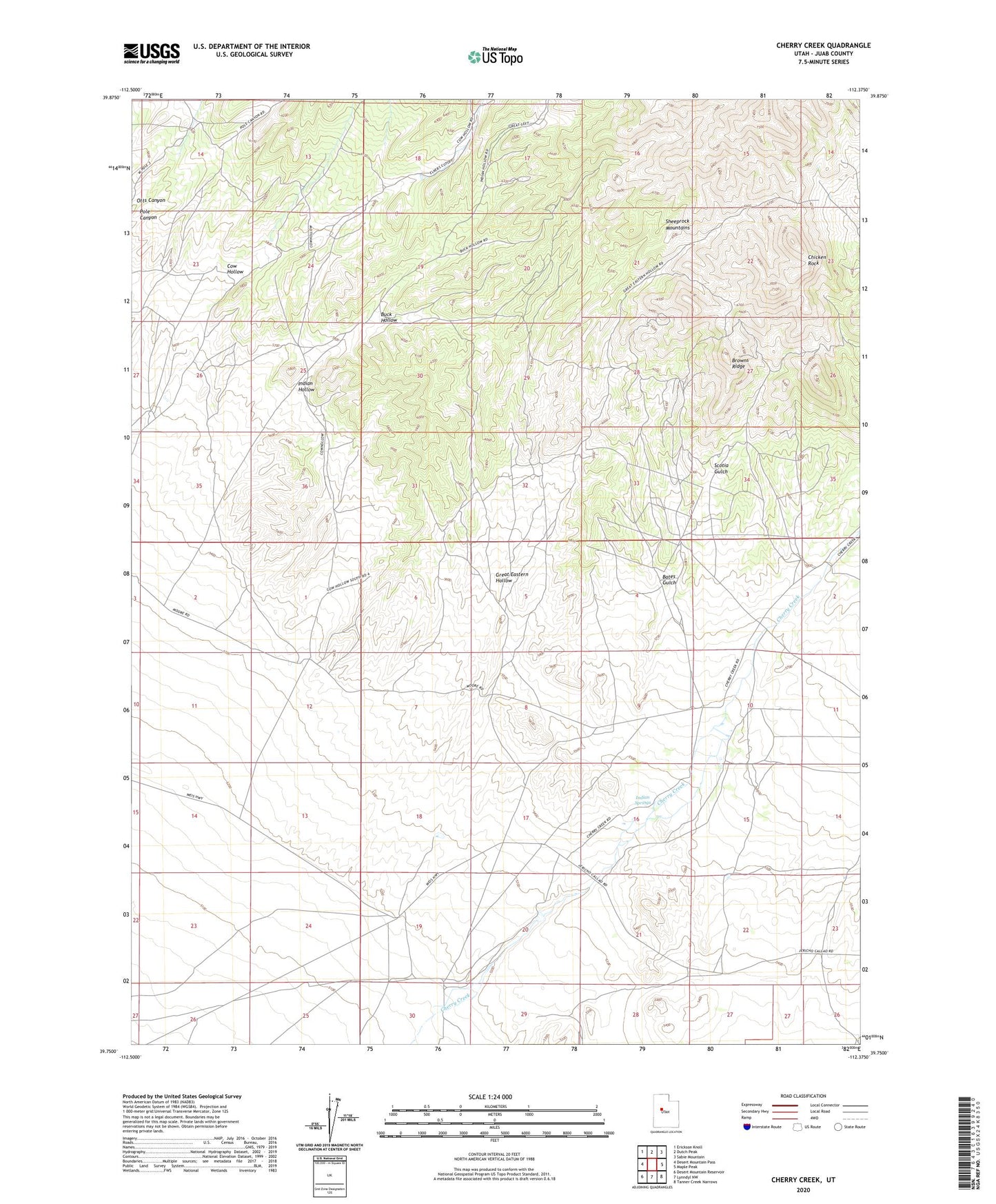
2023 topographic map quadrangle Cherry Creek in the state of Utah. Scale: 1:24000. Based on the newly updated USGS 7.5' US Topo map series, this map is in the following counties: Juab. The map contains contour data, water features, and other items you are used to seeing on USGS maps, but also has updated roads and other features. This is the next generation of topographic maps. Printed on high-quality waterproof paper with UV fade-resistant inks.
Quads adjacent to this one:
West: Desert Mountain Pass
Northwest: Erickson Knoll
North: Dutch Peak
Northeast: Sabie Mountain
East: Maple Peak
Southeast: Tanner Creek Narrows
South: Lynndyl NW
Southwest: Desert Mountain Reservoir
This map covers the same area as the classic USGS quad with code o39112g4.
Contains the following named places: Allah Mine, Bates Gulch, Bates Shaft, Bonanza Mine, Browns Ridge, Buck Hollow, Cherry Creek, Chicken Rock, Clyde Ranch, Cow Hollow, Eighty-eight Shaft, Great Eastern Hollow, Great Western King Mine, Indian Hollow, Indian Springs, Iron King Mine, Jones Mine, Lead King Mine, Murphy Mine, Orient Mine, Oro Plata Mine, Otts Canyon, Pole Canyon, Pyramid Mine, Resurrection Mine, Rockwell Ranch, Scotia Gulch, Scotia Mine, Sullivan Shaft, Tintic Western Mine, Walker Shaft, War Eagle Mine