MyTopo
Devils Hole Utah US Topo Map
Couldn't load pickup availability
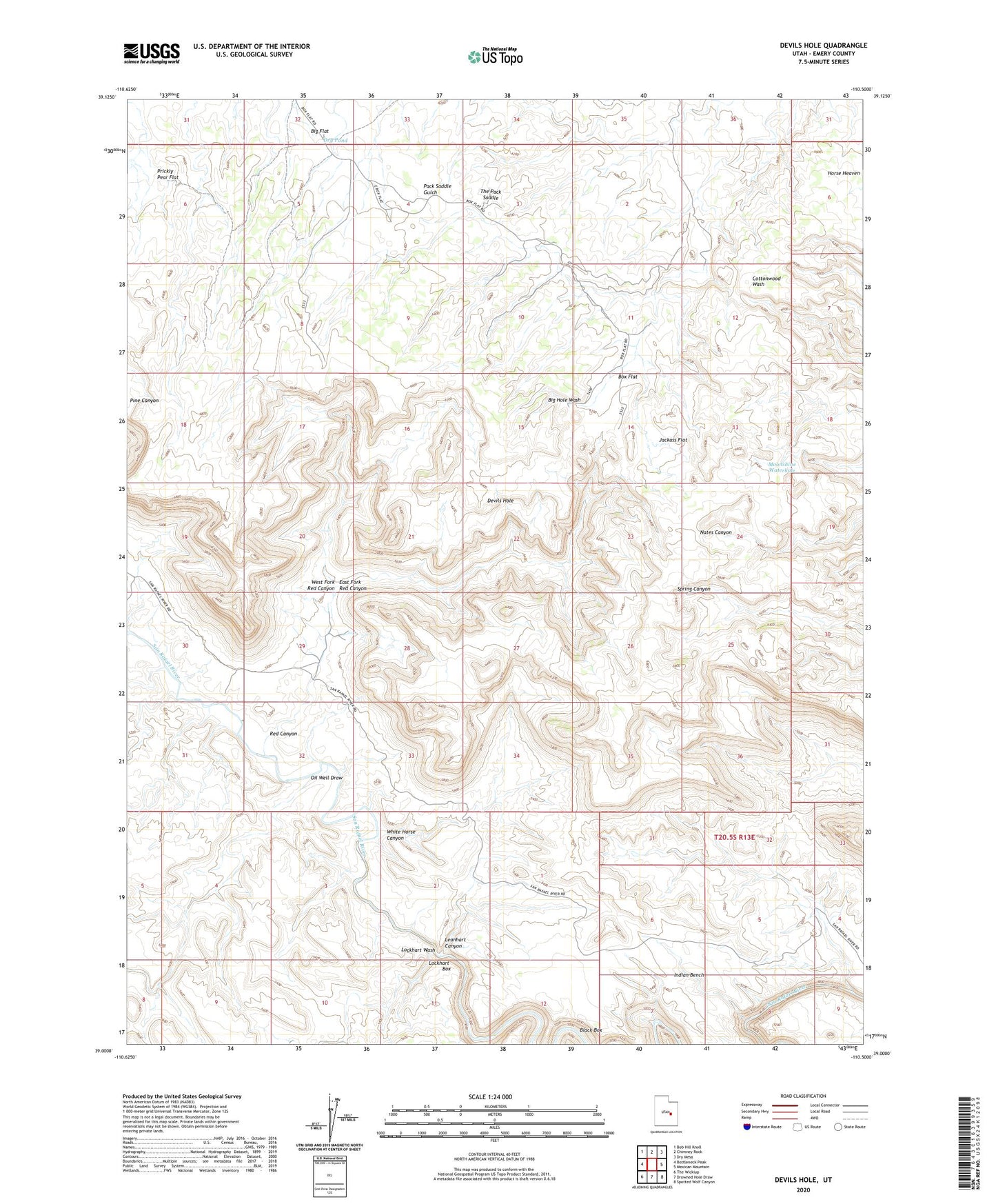
2020 topographic map quadrangle Devils Hole in the state of Utah. Scale: 1:24000. Based on the newly updated USGS 7.5' US Topo map series, this map is in the following counties: Emery. The map contains contour data, water features, and other items you are used to seeing on USGS maps, but also has updated roads and other features. This is the next generation of topographic maps. Printed on high-quality waterproof paper with UV fade-resistant inks.
Quads adjacent to this one:
West: Bottleneck Peak
Northwest: Bob Hill Knoll
North: Chimney Rock
Northeast: Dry Mesa
East: Mexican Mountain
Southeast: Spotted Wolf Canyon
South: Drowned Hole Draw
Southwest: The Wickiup
Contains the following named places: Box Flat, Devils Hole, Dry Pond, East Fork Red Canyon, Indian Bench, Jackass Flat, Leanhart Canyon, Lockhart Box, Lockhart Wash, Moonshine Waterhole, Oil Well Draw, Red Canyon, The Pack Saddle, West Fork Red Canyon, White Horse Canyon