MyTopo
Mexican Mountain Utah US Topo Map
Couldn't load pickup availability
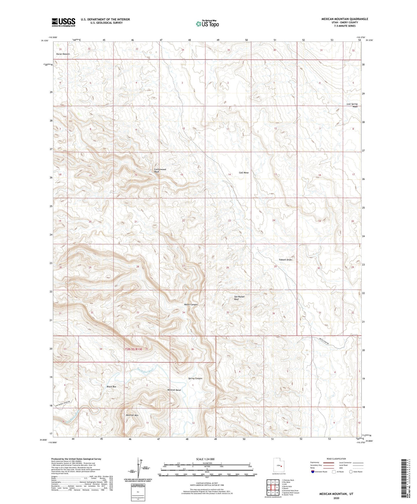
2023 topographic map quadrangle Mexican Mountain in the state of Utah. Scale: 1:24000. Based on the newly updated USGS 7.5' US Topo map series, this map is in the following counties: Emery. The map contains contour data, water features, and other items you are used to seeing on USGS maps, but also has updated roads and other features. This is the next generation of topographic maps. Printed on high-quality waterproof paper with UV fade-resistant inks.
Quads adjacent to this one:
West: Devils Hole
Northwest: Chimney Rock
North: Dry Mesa
Northeast: Cliff
East: Desert
Southeast: Jessies Twist
South: Spotted Wolf Canyon
Southwest: Drowned Hole Draw
This map covers the same area as the classic USGS quad with code o39110a4.
Contains the following named places: Black Box, Calf Mesa, Horse Heaven, Mexican Bend, Mexican Mountain, Nates Canyon, Smith Cabin, Spring Canyon