MyTopo
Bob Hill Knoll Utah US Topo Map
Couldn't load pickup availability
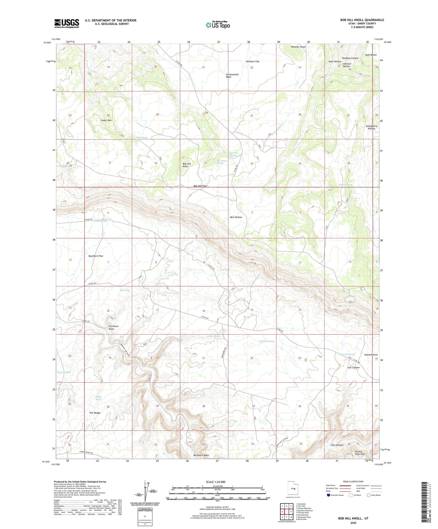
2023 topographic map quadrangle Bob Hill Knoll in the state of Utah. Scale: 1:24000. Based on the newly updated USGS 7.5' US Topo map series, this map is in the following counties: Emery. The map contains contour data, water features, and other items you are used to seeing on USGS maps, but also has updated roads and other features. This is the next generation of topographic maps. Printed on high-quality waterproof paper with UV fade-resistant inks.
Quads adjacent to this one:
West: Buckhorn Reservoir
Northwest: Cleveland
North: Cow Flats
Northeast: Flattop Mountain
East: Chimney Rock
Southeast: Devils Hole
South: Bottleneck Peak
Southwest: Sids Mountain
This map covers the same area as the classic USGS quad with code o39110b6.
Contains the following named places: Aldys Hole, Bitter Seep, Bob Hill Flat, Bob Hill Knoll, Bob Hill Spring, Buckhorn Corral, Cow Canyon, Dog Ponds, Furniture Draw, Gooseberry Hollow, Huff Hollow, Joe Jensen Spring, Johnson Hollow, Little Holes, Mamies Garden, Mud Spring, Orsons Pond, Squaw Spring, Summit Area, Summit Pond, Swazy Hole, The Wedge, Wimmer Flat, Wimmer Knoll