MyTopo
Dry Canyon Mountain Utah US Topo Map
Couldn't load pickup availability
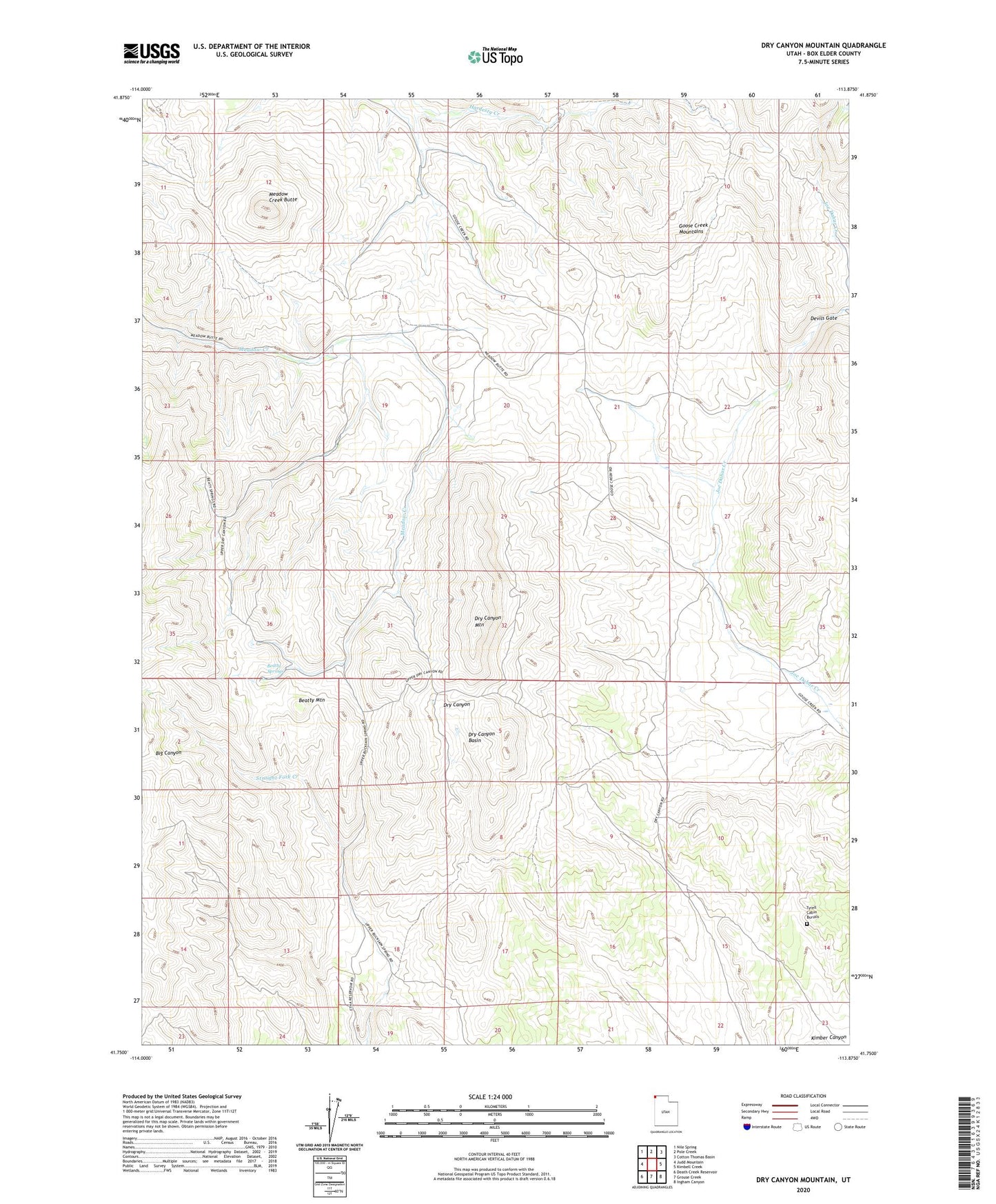
2020 topographic map quadrangle Dry Canyon Mountain in the state of Utah. Scale: 1:24000. Based on the newly updated USGS 7.5' US Topo map series, this map is in the following counties: Box Elder. The map contains contour data, water features, and other items you are used to seeing on USGS maps, but also has updated roads and other features. This is the next generation of topographic maps. Printed on high-quality waterproof paper with UV fade-resistant inks.
Quads adjacent to this one:
West: Judd Mountain
Northwest: Nile Spring
North: Pole Creek
Northeast: Cotton Thomas Basin
East: Kimbell Creek
Southeast: Ingham Canyon
South: Grouse Creek
Southwest: Death Creek Reservoir
Contains the following named places: Beatty Mountain, Beatty Springs, Devils Gate, Dry Canyon Basin, Dry Canyon Mountain, Meadow Creek Butte, Tyrell Cabin Burials