MyTopo
Kimbell Creek Utah US Topo Map
Couldn't load pickup availability
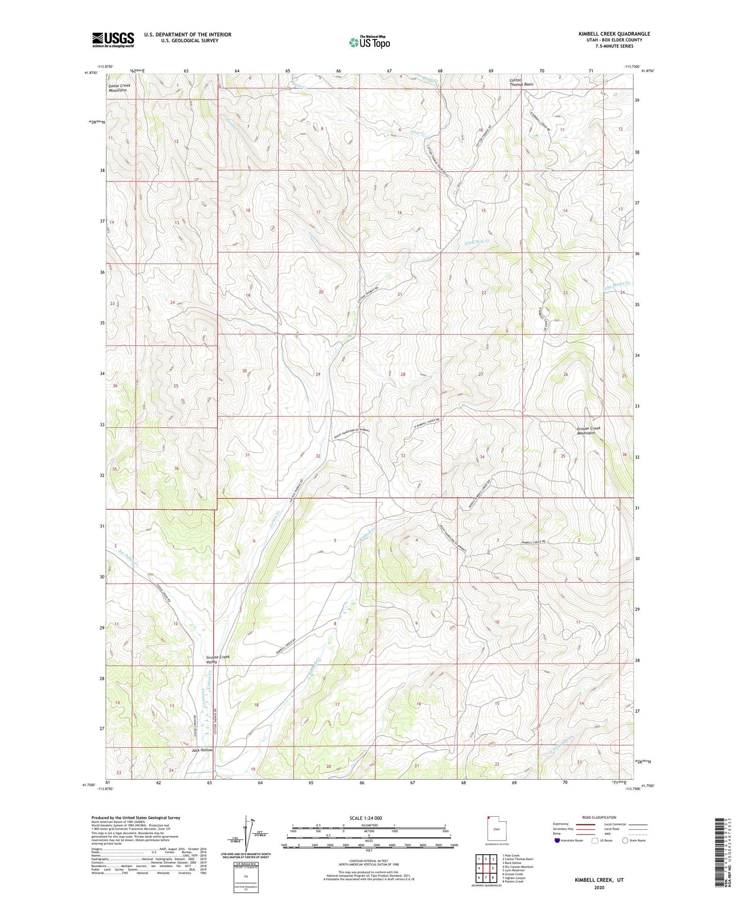
2023 topographic map quadrangle Kimbell Creek in the state of Utah. Scale: 1:24000. Based on the newly updated USGS 7.5' US Topo map series, this map is in the following counties: Box Elder. The map contains contour data, water features, and other items you are used to seeing on USGS maps, but also has updated roads and other features. This is the next generation of topographic maps. Printed on high-quality waterproof paper with UV fade-resistant inks.
Quads adjacent to this one:
West: Dry Canyon Mountain
Northwest: Pole Creek
North: Cotton Thomas Basin
Northeast: Buck Hollow
East: Lynn Reservoir
Southeast: Potters Creek
South: Ingham Canyon
Southwest: Grouse Creek
This map covers the same area as the classic USGS quad with code o41113g7.
Contains the following named places: Cotton Creek, Cotton Thomas Basin, First Creek, Jack Hollow, Joe Dahar Creek, Little Pole Creek, Poison Creek, Quaking Aspen Creek