MyTopo
Dugway Pass Utah US Topo Map
Couldn't load pickup availability
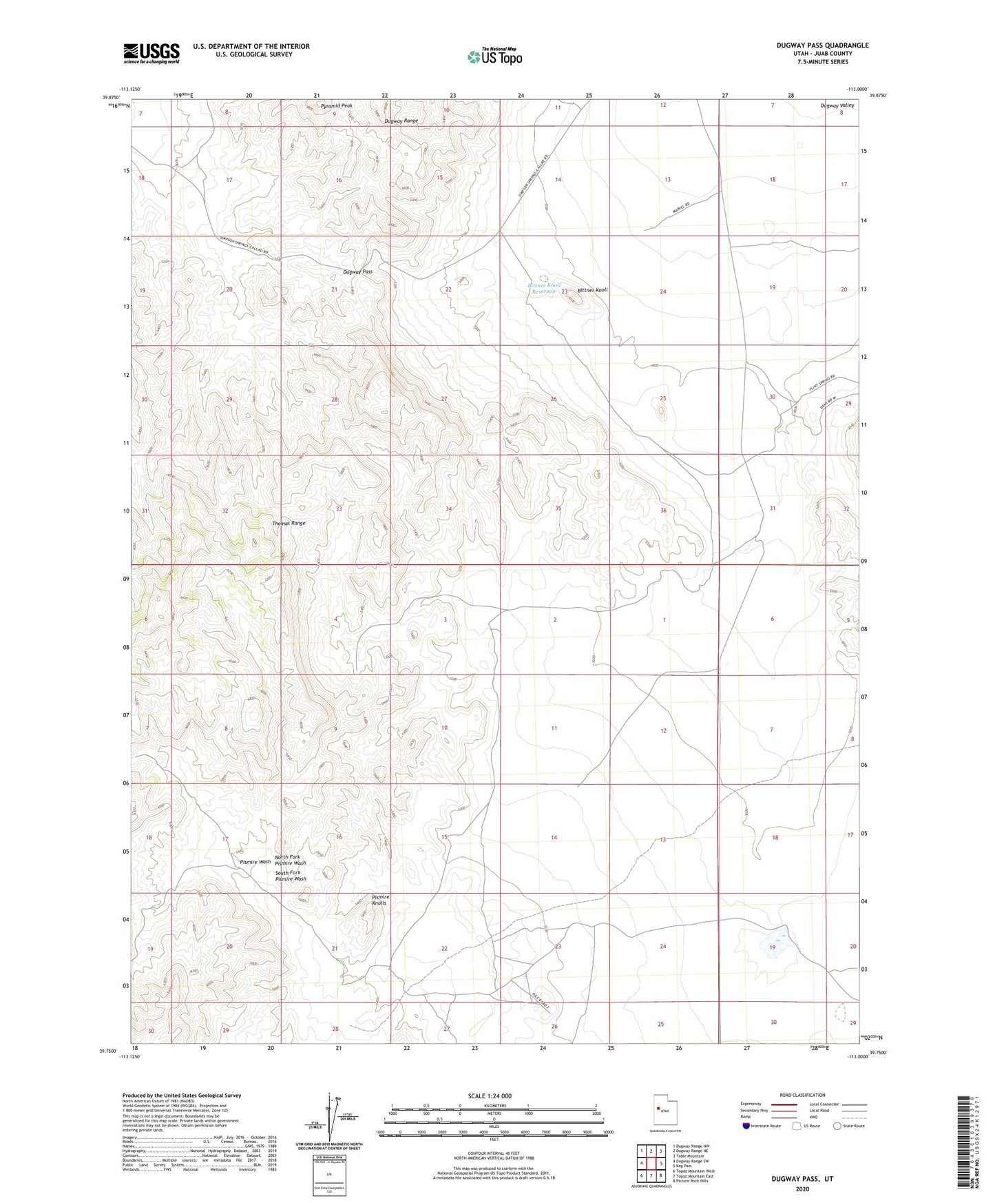
2023 topographic map quadrangle Dugway Pass in the state of Utah. Scale: 1:24000. Based on the newly updated USGS 7.5' US Topo map series, this map is in the following counties: Juab. The map contains contour data, water features, and other items you are used to seeing on USGS maps, but also has updated roads and other features. This is the next generation of topographic maps. Printed on high-quality waterproof paper with UV fade-resistant inks.
Quads adjacent to this one:
West: Dugway Range SW
Northwest: Dugway Range NW
North: Dugway Range NE
Northeast: Table Mountain
East: Keg Pass
Southeast: Picture Rock Hills
South: Topaz Mountain East
Southwest: Topaz Mountain West
This map covers the same area as the classic USGS quad with code o39113g1.
Contains the following named places: Bittner Knoll, Bittner Knoll Reservoir, Dugway Pass, Dugway Pony Express Station, East Topaz 2 Reservoir, North Fork Pismire Wash, Pismire Knolls, Pyramid Peak, South Fork Pismire Wash