MyTopo
East Promontory Utah US Topo Map
Couldn't load pickup availability
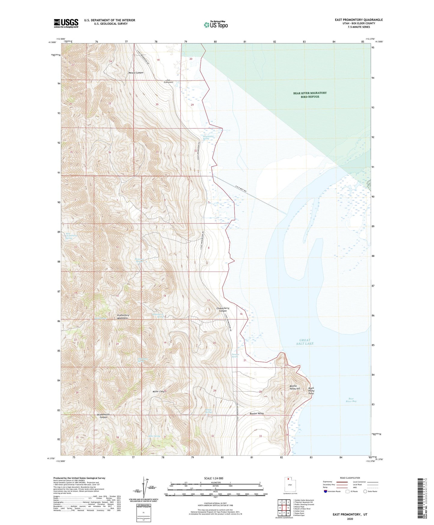
2023 topographic map quadrangle East Promontory in the state of Utah. Scale: 1:24000. Based on the newly updated USGS 7.5' US Topo map series, this map is in the following counties: Box Elder. The map contains contour data, water features, and other items you are used to seeing on USGS maps, but also has updated roads and other features. This is the next generation of topographic maps. Printed on high-quality waterproof paper with UV fade-resistant inks.
Quads adjacent to this one:
West: Messix Peak
Northwest: Golden Spike Monument
North: Thatcher Mountain SW
Northeast: Public Shooting Grounds
East: Mouth of Bear River
Southeast: Willard Spur
South: Pokes Point
Southwest: Indian Cove
This map covers the same area as the classic USGS quad with code o41112d4.
Contains the following named places: Black Rocky Point, Boothe Valley Hill, Chokecherry Canyon, Chokecherry Spring, East Promontory, Messix Canyon, Miller Spring, Mountain Springs, Owen Spring, Parsons Spring, Promontory Mountains, Sweetwater Spring, West Chokecherry Spring, Wild Horse Spring, Willow Springs