MyTopo
Public Shooting Grounds Utah US Topo Map
Couldn't load pickup availability
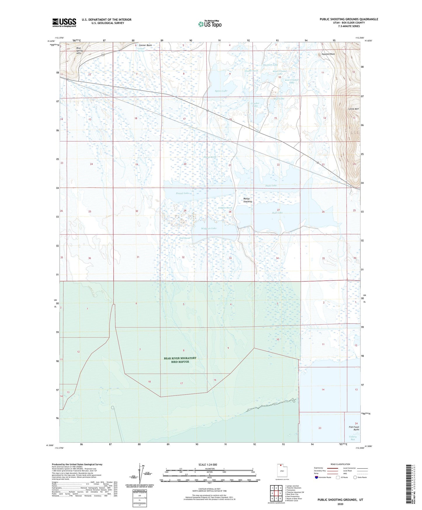
2023 topographic map quadrangle Public Shooting Grounds in the state of Utah. Scale: 1:24000. Based on the newly updated USGS 7.5' US Topo map series, this map is in the following counties: Box Elder. The map contains contour data, water features, and other items you are used to seeing on USGS maps, but also has updated roads and other features. This is the next generation of topographic maps. Printed on high-quality waterproof paper with UV fade-resistant inks.
Quads adjacent to this one:
West: Thatcher Mountain SW
Northwest: Lampo Junction
North: Thatcher Mountain
Northeast: Tremonton
East: Bear River City
Southeast: Whistler Canal
South: Mouth of Bear River
Southwest: East Promontory
This map covers the same area as the classic USGS quad with code o41112e3.
Contains the following named places: Conner Basin, Connor Springs, Crocker Lake, Crocker Marsh, Division Lake, Duck Lake, East Crocker Lake, Fish Fossil Rocks, Hull Canal, Hull Lake, Mollys Stocking, Mud Lake, Painted Rock, Pintail Lake, Pintail Marsh, Public Shooting Grounds Waterfowl Management Area, Spires Lake, West Crocker Lake, West Marsh, Widgeon Lake, Widgeon Marsh