MyTopo
Fairview Utah US Topo Map
Couldn't load pickup availability
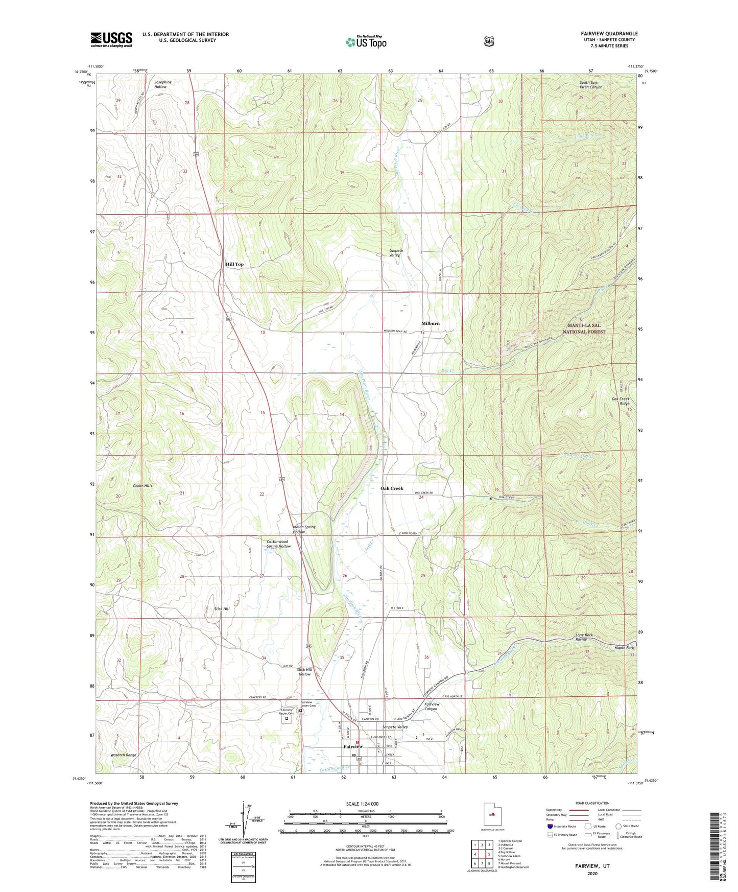
2020 topographic map quadrangle Fairview in the state of Utah. Scale: 1:24000. Based on the newly updated USGS 7.5' US Topo map series, this map is in the following counties: Sanpete. The map contains contour data, water features, and other items you are used to seeing on USGS maps, but also has updated roads and other features. This is the next generation of topographic maps. Printed on high-quality waterproof paper with UV fade-resistant inks.
Quads adjacent to this one:
West: Big Hollow
Northwest: Spencer Canyon
North: Indianola
Northeast: C Canyon
East: Fairview Lakes
Southeast: Huntington Reservoir
South: Mount Pleasant
Southwest: Moroni
Contains the following named places: City of Fairview, Cottonwood Spring Hollow, Crooked Creek, Dry Creek, Fairview, Fairview Ambulance Association, Fairview Canyon, Fairview Elementary School, Fairview Lower Cemetery, Fairview Police Department, Fairview Post Office, Fairview Upper Cemetery, Fairview Volunteer Fire Department, Hill Top, Hilltop Wildlife Management Area, Indian Spring Hollow, Josephine Hollow, Left Fork Oak Creek, Lone Pine Creek, Lone Rock Ravine, Maple Fork, Milburn, Mud Spring Wash, North Fork Mud Spring Wash, Oak Creek, Slick Hill, Slick Hill Hollow, The Church of Jesus Christ of Latter Day Saints