MyTopo
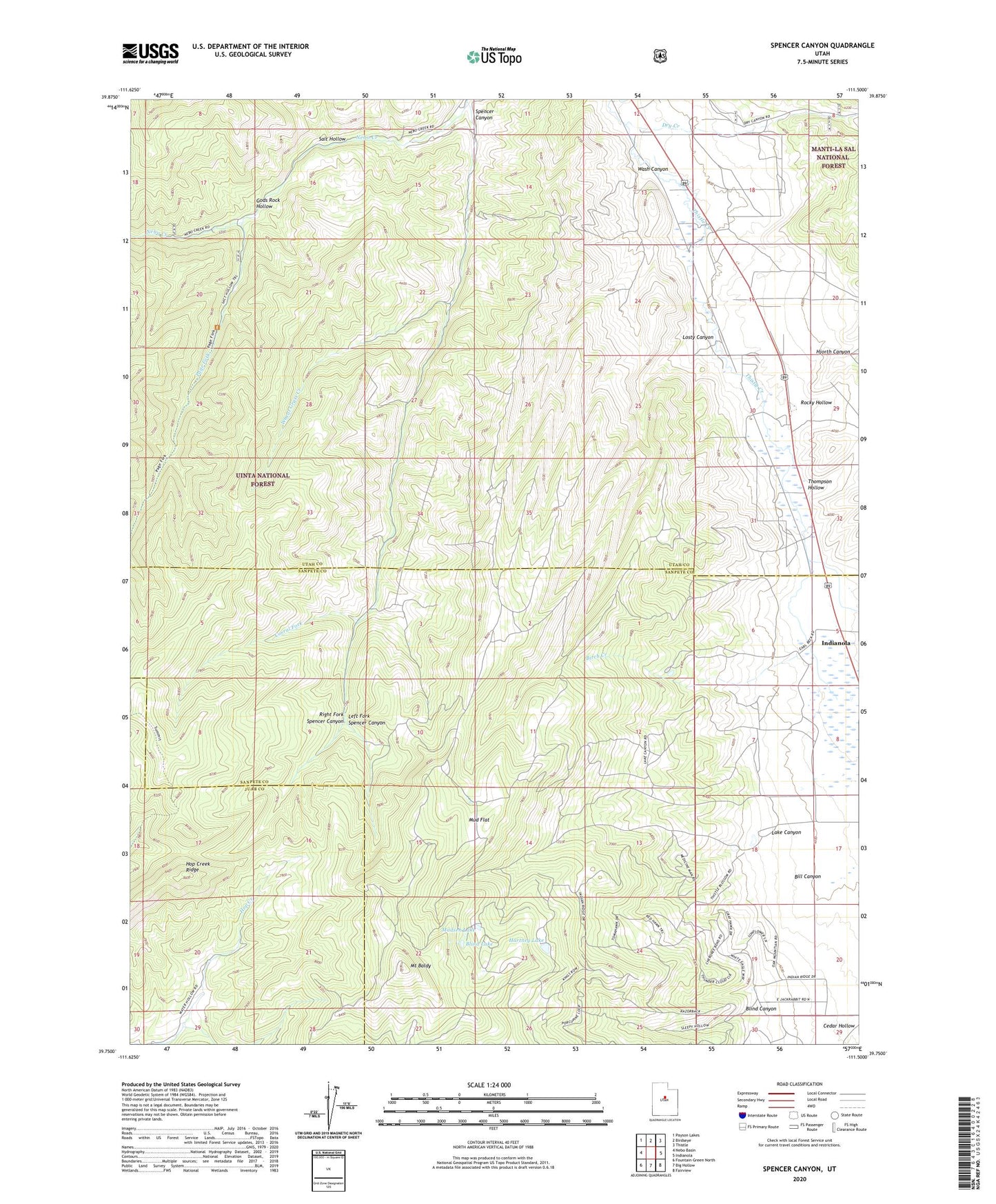
Spencer Canyon Utah US Topo Map
Couldn't load pickup availability
Also explore the Spencer Canyon Forest Service Topo of this same quad for updated USFS data
2023 topographic map quadrangle Spencer Canyon in the state of Utah. Scale: 1:24000. Based on the newly updated USGS 7.5' US Topo map series, this map is in the following counties: Utah, Sanpete, Juab. The map contains contour data, water features, and other items you are used to seeing on USGS maps, but also has updated roads and other features. This is the next generation of topographic maps. Printed on high-quality waterproof paper with UV fade-resistant inks.
Quads adjacent to this one:
West: Nebo Basin
Northwest: Payson Lakes
North: Birdseye
Northeast: Thistle
East: Indianola
Southeast: Fairview
South: Big Hollow
Southwest: Fountain Green North
This map covers the same area as the classic USGS quad with code o39111g5.
Contains the following named places: Bill Canyon, Birch Creek, Blind Canyon, Blind Lake, Cedar Hollow, Corral Fork, Dry Creek, Gods Rock Hollow, Hartney Lake, Hjorth Canyon, Hop Creek Ridge, Lake Canyon, Left Fork Spencer Canyon, Losty Canyon, Madsen Lake, Mount Baldy, Mud Flat, Page Fork, Right Fork Spencer Canyon, Rocky Hollow, Salt Hollow, Spencer Canyon, Spencer Fork Wildlife Management Area, Thompson Hollow, Wash Canyon, Wheat Grass Creek