MyTopo
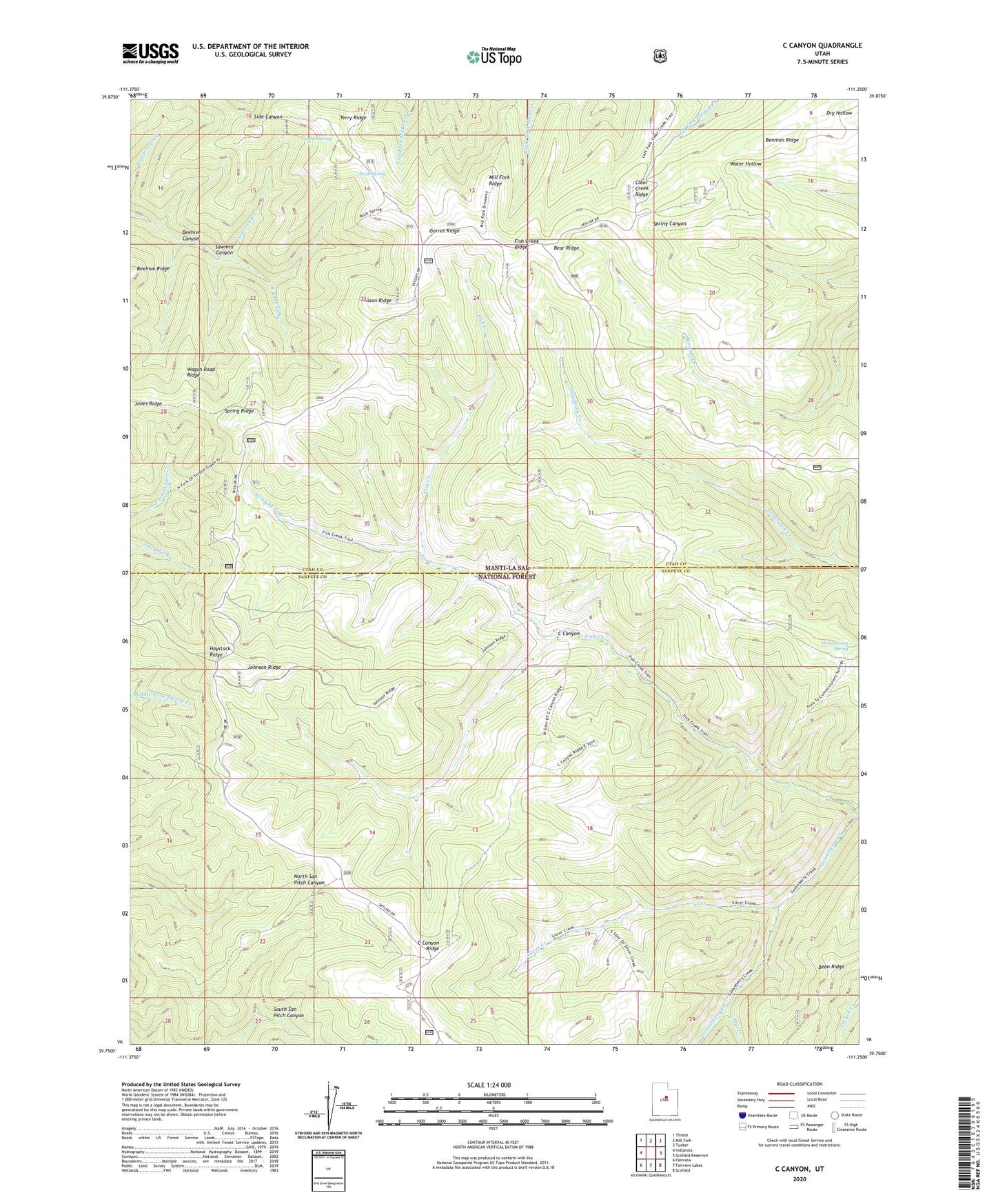
C Canyon Utah US Topo Map
Couldn't load pickup availability
Also explore the C Canyon Forest Service Topo of this same quad for updated USFS data
2023 topographic map quadrangle C Canyon in the state of Utah. Scale: 1:24000. Based on the newly updated USGS 7.5' US Topo map series, this map is in the following counties: Utah, Sanpete. The map contains contour data, water features, and other items you are used to seeing on USGS maps, but also has updated roads and other features. This is the next generation of topographic maps. Printed on high-quality waterproof paper with UV fade-resistant inks.
Quads adjacent to this one:
West: Indianola
Northwest: Thistle
North: Mill Fork
Northeast: Tucker
East: Scofield Reservoir
Southeast: Scofield
South: Fairview Lakes
Southwest: Fairview
This map covers the same area as the classic USGS quad with code o39111g3.
Contains the following named places: Bear Ridge, Beehive Canyon, Bennion Ridge, C Canyon, C Canyon Ridge, Clear Creek Ridge, Commissary Spring, Fish Creek National Recreation Trail, Fish Creek Ridge, Garret Fork, Garret Ridge, Garret Spring, Haystack Ridge, Johnson Ridge, Johnson Ridge Overlook, Jones Ridge, Mill Creek, Mill Fork Ridge, Poison Ridge, Rock Spring, Sawmill Canyon, Silver Creek, Spring Ridge, Spring Ridge Administrative Site, Straight Fork, Terry Ridge, Wagon Road Ridge