MyTopo
Mount Waas Utah US Topo Map
Couldn't load pickup availability
Also explore the Mount Waas Forest Service Topo of this same quad for updated USFS data
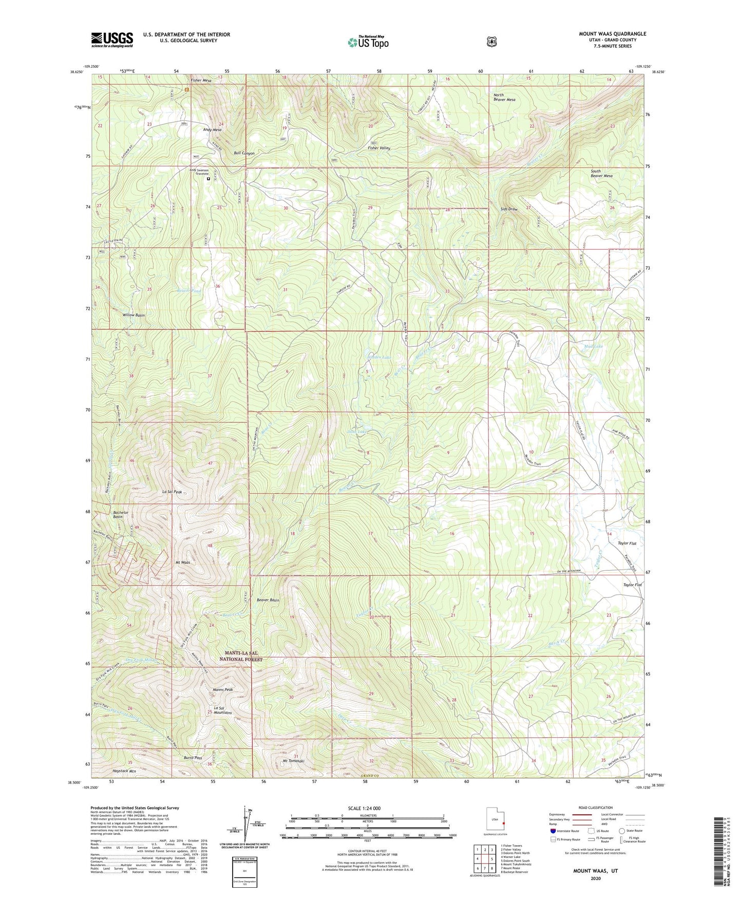
2023 topographic map quadrangle Mount Waas in the state of Utah. Scale: 1:24000. Based on the newly updated USGS 7.5' US Topo map series, this map is in the following counties: Grand. The map contains contour data, water features, and other items you are used to seeing on USGS maps, but also has updated roads and other features. This is the next generation of topographic maps. Printed on high-quality waterproof paper with UV fade-resistant inks.
Quads adjacent to this one:
West: Warner Lake
Northwest: Fisher Towers
North: Fisher Valley
Northeast: Dolores Point North
East: Dolores Point South
Southeast: Buckeye Reservoir
South: Mount Peale
Southwest: Mount Tukuhnikivatz
This map covers the same area as the classic USGS quad with code o38109e2.
Contains the following named places: Andy Mesa, Andy Swenson Gravesite, Bachelor Basin, Bear Creek, Beaver Basin, Beaver Pond, Beaver Ponds, Burro Pass, Dons Lake, Fisher Mesa, Hidden Lake, La Sal Peak, Manns Peak, Mount Tomasaki, Mount Waas, Mud Lake, Sids Draw, Taylor Flat, Willow Basin