MyTopo
Fisher Valley Utah US Topo Map
Couldn't load pickup availability
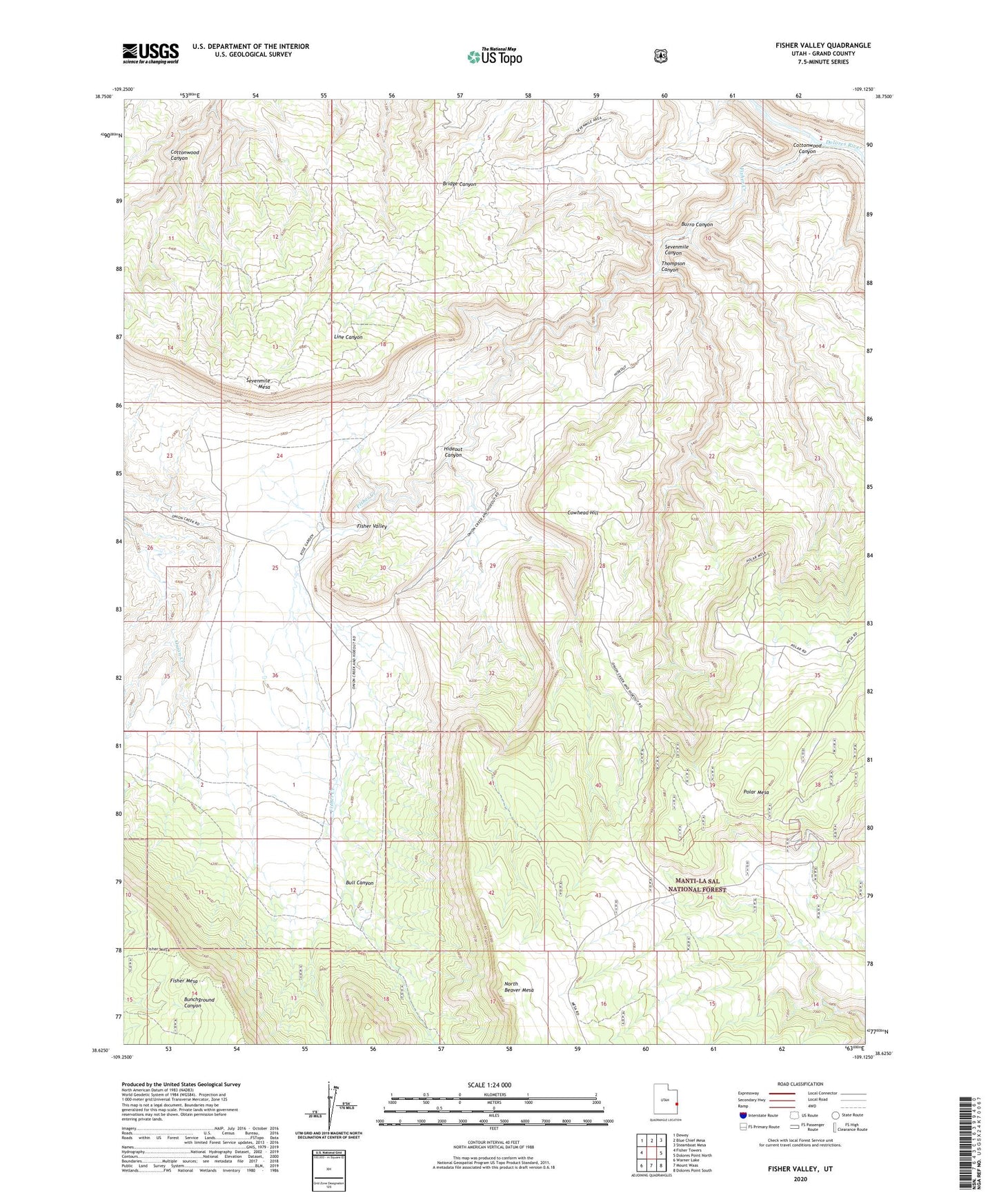
2020 topographic map quadrangle Fisher Valley in the state of Utah. Scale: 1:24000. Based on the newly updated USGS 7.5' US Topo map series, this map is in the following counties: Grand. The map contains contour data, water features, and other items you are used to seeing on USGS maps, but also has updated roads and other features. This is the next generation of topographic maps. Printed on high-quality waterproof paper with UV fade-resistant inks.
Quads adjacent to this one:
West: Fisher Towers
Northwest: Dewey
North: Blue Chief Mesa
Northeast: Steamboat Mesa
East: Dolores Point North
Southeast: Dolores Point South
South: Mount Waas
Southwest: Warner Lake
Contains the following named places: Bull Canyon, Burro Canyon, Cottonwood Canyon, Cowhead Hill, Fisher Creek, Fisher Valley, Hideout Canyon, North Beaver Mesa, Polar Mesa, Sevenmile Canyon, Sevenmile Mesa, Thompson Canyon