MyTopo
Steamboat Mesa Utah US Topo Map
Couldn't load pickup availability
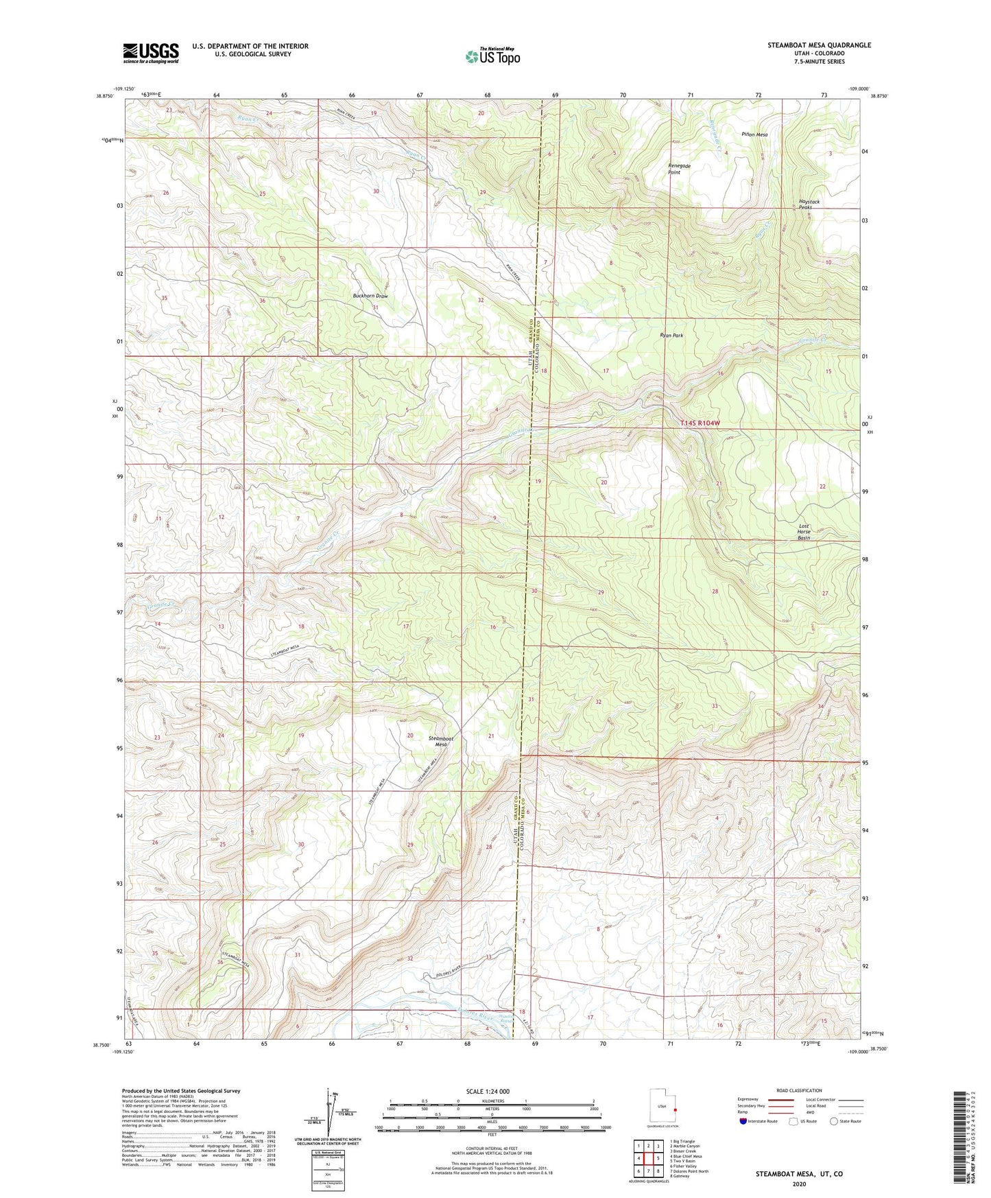
2023 topographic map quadrangle Steamboat Mesa in the states of Utah, Colorado. Scale: 1:24000. Based on the newly updated USGS 7.5' US Topo map series, this map is in the following counties: Grand, Mesa. The map contains contour data, water features, and other items you are used to seeing on USGS maps, but also has updated roads and other features. This is the next generation of topographic maps. Printed on high-quality waterproof paper with UV fade-resistant inks.
Quads adjacent to this one:
West: Blue Chief Mesa
Northwest: Big Triangle
North: Marble Canyon
Northeast: Bieser Creek
East: Two V Basin
Southeast: Gateway
South: Dolores Point North
Southwest: Fisher Valley
This map covers the same area as the classic USGS quad with code o38109g1.
Contains the following named places: Haystack Peaks, Renegade Point, Ryan Park, Stateline Rapids, Steamboat Mesa