MyTopo
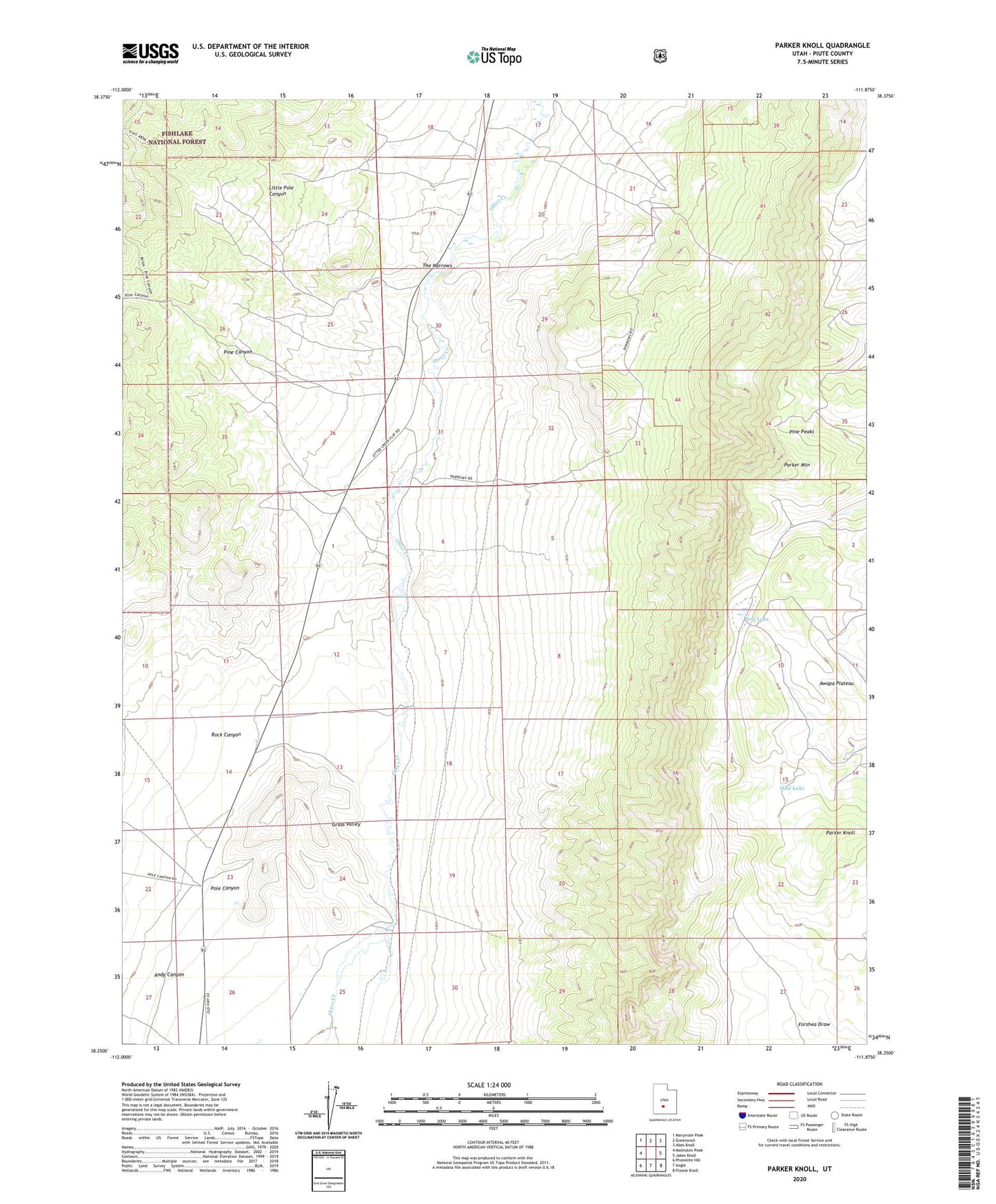
Parker Knoll Utah US Topo Map
Couldn't load pickup availability
Also explore the Parker Knoll Forest Service Topo of this same quad for updated USFS data
2023 topographic map quadrangle Parker Knoll in the state of Utah. Scale: 1:24000. Based on the newly updated USGS 7.5' US Topo map series, this map is in the following counties: Piute. The map contains contour data, water features, and other items you are used to seeing on USGS maps, but also has updated roads and other features. This is the next generation of topographic maps. Printed on high-quality waterproof paper with UV fade-resistant inks.
Quads adjacent to this one:
West: Malmsten Peak
Northwest: Marysvale Peak
North: Greenwich
Northeast: Abes Knoll
East: Jakes Knoll
Southeast: Flossie Knoll
South: Angle
Southwest: Phonolite Hill
This map covers the same area as the classic USGS quad with code o38111c8.
Contains the following named places: Andy Canyon, Dog Lake, Grass Valley, Little Pole Canyon, Mud Lake, Parker Knoll, Parker Mountain, Pine Canyon, Pine Peaks, Pole Canyon, Rock Canyon, The Narrows