MyTopo
Floy Canyon South Utah US Topo Map
Couldn't load pickup availability
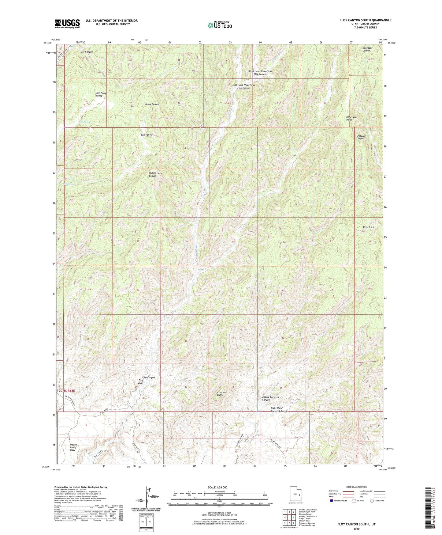
2023 topographic map quadrangle Floy Canyon South in the state of Utah. Scale: 1:24000. Based on the newly updated USGS 7.5' US Topo map series, this map is in the following counties: Grand. The map contains contour data, water features, and other items you are used to seeing on USGS maps, but also has updated roads and other features. This is the next generation of topographic maps. Printed on high-quality waterproof paper with UV fade-resistant inks.
Quads adjacent to this one:
West: Bobby Canyon South
Northwest: Bobby Canyon North
North: Floy Canyon North
Northeast: Bogart Canyon
East: Sego Canyon
Southeast: Thompson Springs
South: Crescent Junction
Southwest: Hatch Mesa
This map covers the same area as the classic USGS quad with code o39109a7.
Contains the following named places: Crescent Butte, Crescent Mine, Cub Spring, Cub Valley, Deer Point, Dry Fork, Floy Canyon, Left Hand Threeforks Floy Canyon, Middle Crescent Canyon, Renegade Point, Right Hand Crescent Canyon, Right Hand Threeforks Floy Canyon, Tom Farrer Valley, Tom Spring, Ute Canyon