MyTopo
Forsyth Reservoir Utah US Topo Map
Couldn't load pickup availability
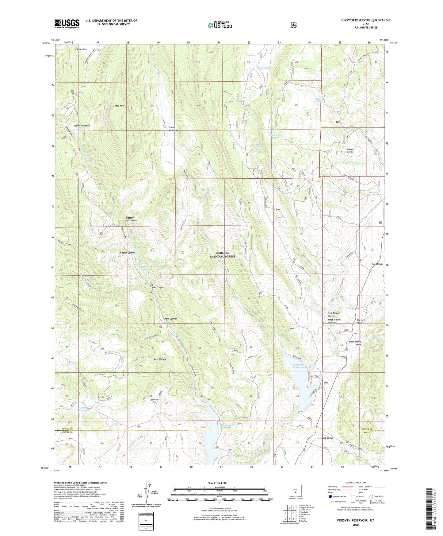
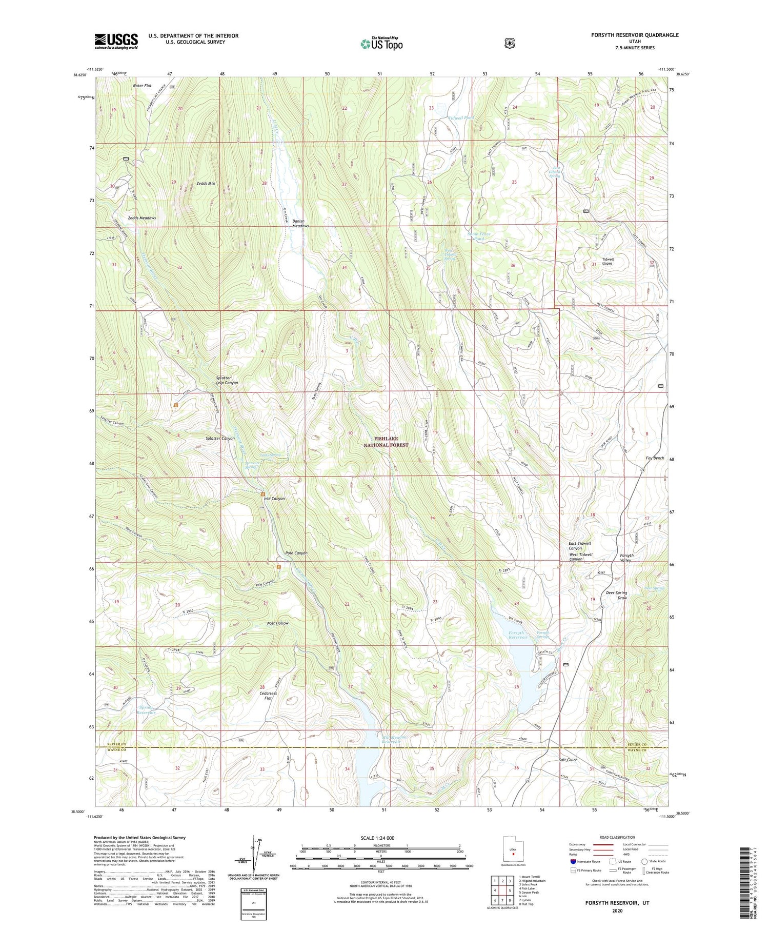
2020 topographic map quadrangle Forsyth Reservoir in the state of Utah. Scale: 1:24000. Based on the newly updated USGS 7.5' US Topo map series, this map is in the following counties: Sevier, Wayne. The map contains contour data, water features, and other items you are used to seeing on USGS maps, but also has updated roads and other features. This is the next generation of topographic maps. Printed on high-quality waterproof paper with UV fade-resistant inks.
Quads adjacent to this one:
West: Fish Lake
Northwest: Mount Terrill
North: Hilgard Mountain
Northeast: Johns Peak
East: Geyser Peak
Southeast: Flat Top
South: Lyman
Southwest: Loa
Contains the following named places: Cedarless Flat, Danish Meadows, Deer Spring, Deer Spring Draw, East Tidwell Canyon, East Tidwell Spring, Forsyth Dam, Forsyth Reservoir, Forsyth Springs, Foy Bench, Ivie Canyon, Mamoits Spring, Mill Meadow Reservoir, Pah Ga Ne A Campground, Paraboo Campground, Pole Campground, Pole Canyon, Post Hollow, Salt Gulch, Short Creek, Snow Fence Pond, Splatter Canyon, Splatter Drip Canyon, Spring Reservoir, Tidwell Pond, Tidwell Slopes, Toats Campground, Toats Spring, U M Creek, West Tidwell Canyon, West Tidwell Spring, Zedds Campground, Zedds Meadows, Zedds Mountain