MyTopo
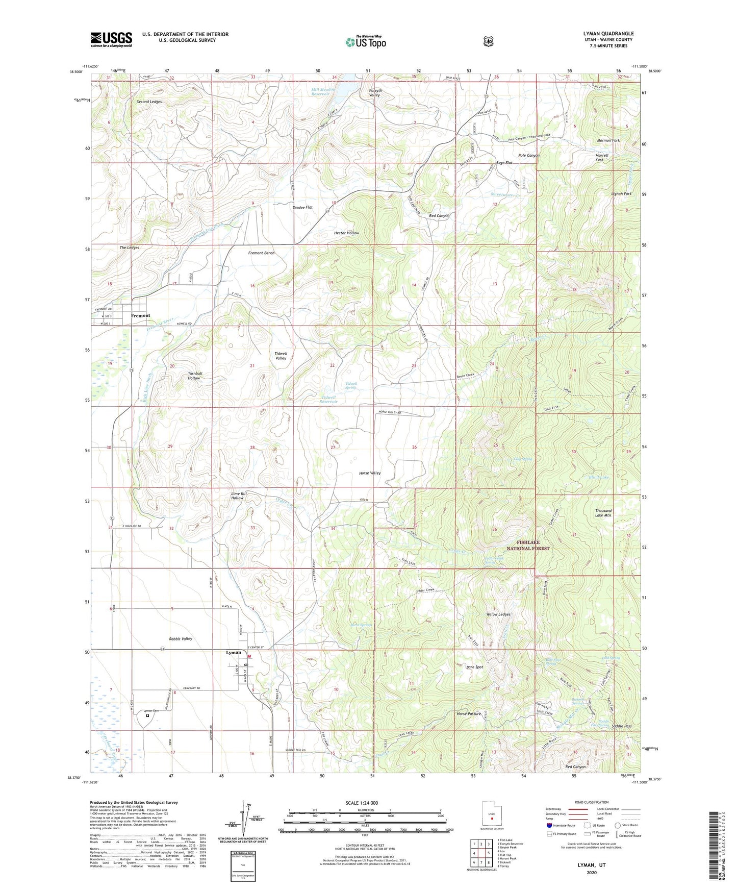
Lyman Utah US Topo Map
Couldn't load pickup availability
Also explore the Lyman Forest Service Topo of this same quad for updated USFS data
2023 topographic map quadrangle Lyman in the state of Utah. Scale: 1:24000. Based on the newly updated USGS 7.5' US Topo map series, this map is in the following counties: Wayne. The map contains contour data, water features, and other items you are used to seeing on USGS maps, but also has updated roads and other features. This is the next generation of topographic maps. Printed on high-quality waterproof paper with UV fade-resistant inks.
Quads adjacent to this one:
West: Loa
Northwest: Fish Lake
North: Forsyth Reservoir
Northeast: Geyser Peak
East: Flat Top
Southeast: Torrey
South: Bicknell
Southwest: Moroni Peak
This map covers the same area as the classic USGS quad with code o38111d5.
Contains the following named places: Bare Spot, Bare Spot Spring, Bicknell Springs, Blind Lake, Burnt Springs, Cedar Creek, Cedar Creek Spring, Clay Spring, Cold Spring, Forsyth Valley, Fremont, Fremont Bench, Fremont Census Designated Place, Hector Hollow, High Line Ditch, Highline Ditch, Horse Pasture, Horse Valley, Jackson Dugway, Lighah Fork, Lime Kill Hollow, Lyges Fork, Lyman, Lyman Cemetery, Lyman Fire Department, Lyman Post Office, Mill Meadow Dam, Mormon Fork, Morrell Fork, Pole Canyon, Red Canyon, Reese Creek, Saddle Pass, Saddle Pass Spring, Sage Flat, Second Ledges, Sweetwater Creek, Teedee Flat, The Church of Jesus Christ of Latter Day Saints, The Ledges, Tidwell Reservoir, Tidwell Spring, Tidwell Valley, Town of Lyman, Turnbull Hollow, Yellow Ledges, ZIP Code: 84749