MyTopo
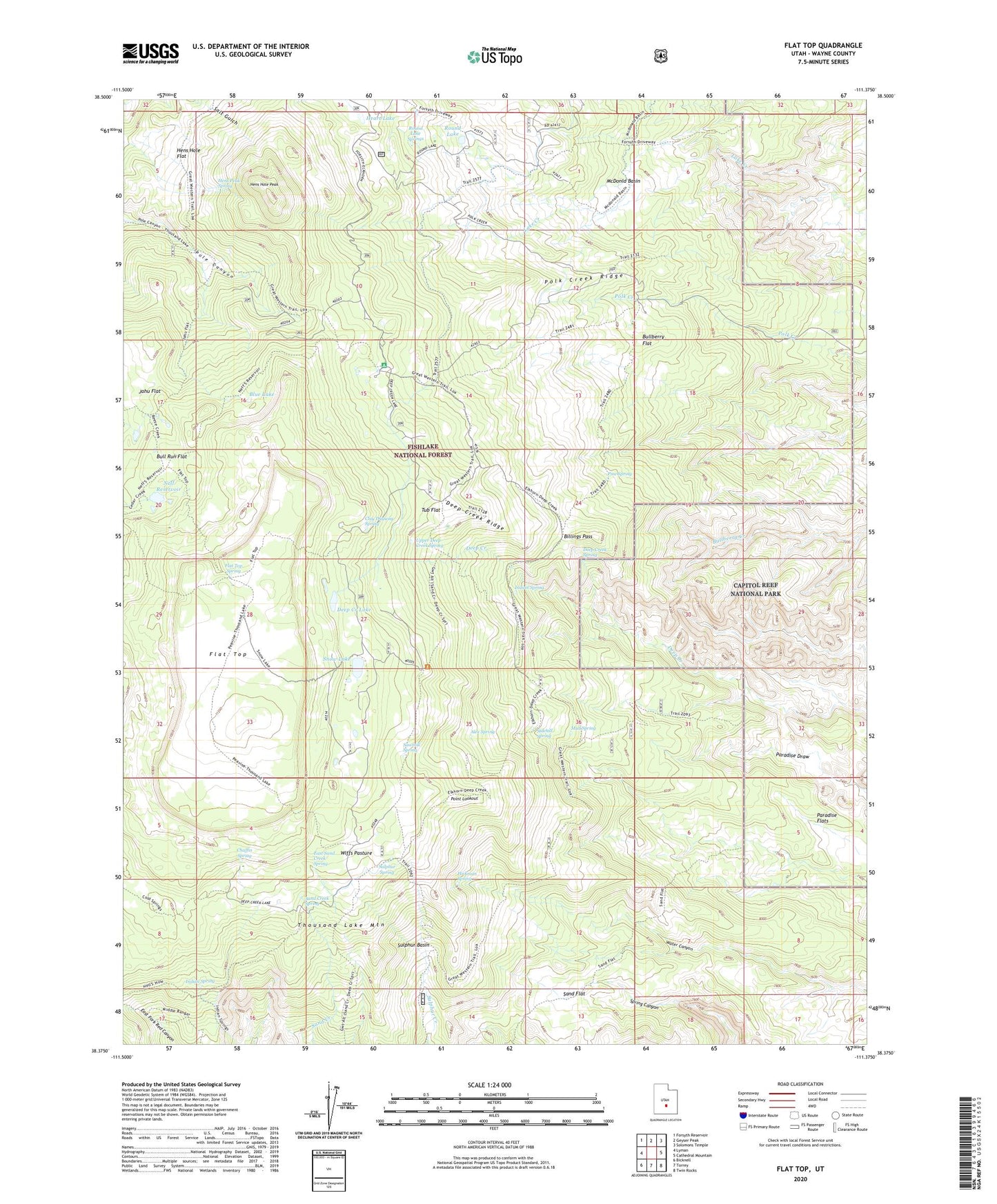
Flat Top Utah US Topo Map
Couldn't load pickup availability
Also explore the Flat Top Forest Service Topo of this same quad for updated USFS data
2023 topographic map quadrangle Flat Top in the state of Utah. Scale: 1:24000. Based on the newly updated USGS 7.5' US Topo map series, this map is in the following counties: Wayne. The map contains contour data, water features, and other items you are used to seeing on USGS maps, but also has updated roads and other features. This is the next generation of topographic maps. Printed on high-quality waterproof paper with UV fade-resistant inks.
Quads adjacent to this one:
West: Lyman
Northwest: Forsyth Reservoir
North: Geyser Peak
Northeast: Solomons Temple
East: Cathedral Mountain
Southeast: Twin Rocks
South: Torrey
Southwest: Bicknell
This map covers the same area as the classic USGS quad with code o38111d4.
Contains the following named places: Alex Spring, Billings Pass, Blue Lake, Bull Run Flat, Bullberry Flat, Bullings Pass, Chaffin Spring, Clay Dugway Spring, Deep Creek Lake, Deep Creek Ridge, Deep Creek Spring, East Sand Creek Spring, Elkhorn Campground, Elkhorn Guard Station, Elkhorn Ranger Station and Forest Camp, Flat Top, Flat Top Spring, Heart Lake, Hens Hole Flat, Hens Hole Peak, Hens Peak Spring, Hickman Spring, Indian Spring, Jahu Flat, Lake Creek, McDonld Basin, Mud Spring, Neff Reservoir, Neffs Dam, Pine Spring, Point Lookout, Polk Creek Ridge, Round Lake, Round Lake Springs, Sand Creek Spring, Sand Flat, Sawmill Spring, Sidehill Spring, Snow Lake, Sulphur Basin, Sulphur Spring, Thousand Lake Mountain, Tub Flat, Upper Deep Creek Spring, Wiffs Pasture