MyTopo
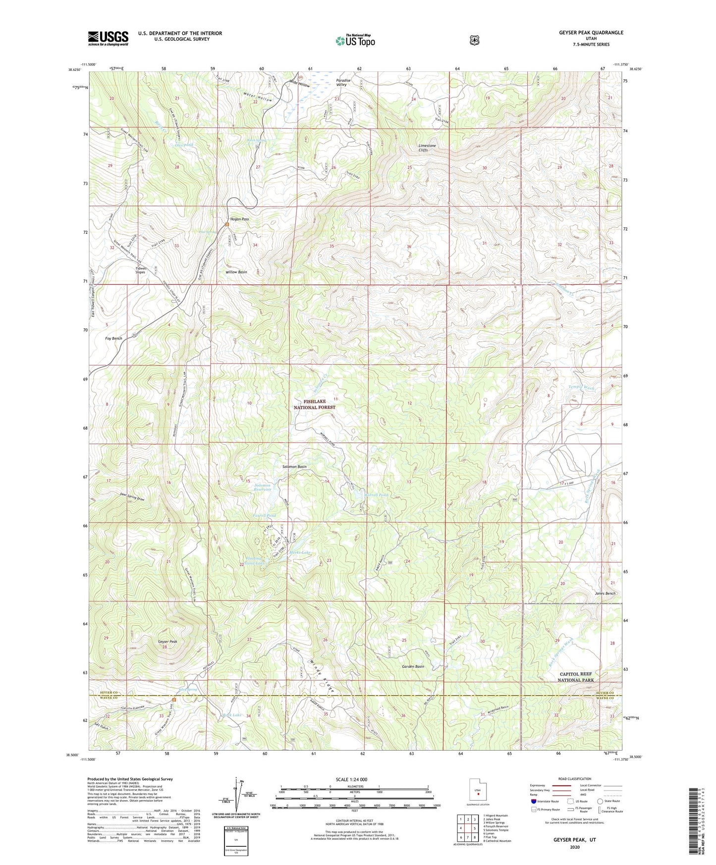
Geyser Peak Utah US Topo Map
Couldn't load pickup availability
Also explore the Geyser Peak Forest Service Topo of this same quad for updated USFS data
2023 topographic map quadrangle Geyser Peak in the state of Utah. Scale: 1:24000. Based on the newly updated USGS 7.5' US Topo map series, this map is in the following counties: Sevier, Wayne. The map contains contour data, water features, and other items you are used to seeing on USGS maps, but also has updated roads and other features. This is the next generation of topographic maps. Printed on high-quality waterproof paper with UV fade-resistant inks.
Quads adjacent to this one:
West: Forsyth Reservoir
Northwest: Hilgard Mountain
North: Johns Peak
Northeast: Willow Springs
East: Solomons Temple
Southeast: Cathedral Mountain
South: Flat Top
Southwest: Lyman
This map covers the same area as the classic USGS quad with code o38111e4.
Contains the following named places: Birch Creek, Birch Spring, Desert View Area, Farrell Pond, Floating Island Lake, Garden Basin, Geyser Peak, Hogan Pass, Jones Bench, Meadow Gulch Salt Gulch Trail, Meeks Lake, Morrell Pond, Oles Pond, Pine Spring, Riley Spring, Rock Lake, Solomon Basin, Solomon Reservoir, Water Hollow, Wide Hollow, Willow Basin, Windy Ridge