MyTopo
Government Point Utah US Topo Map
Couldn't load pickup availability
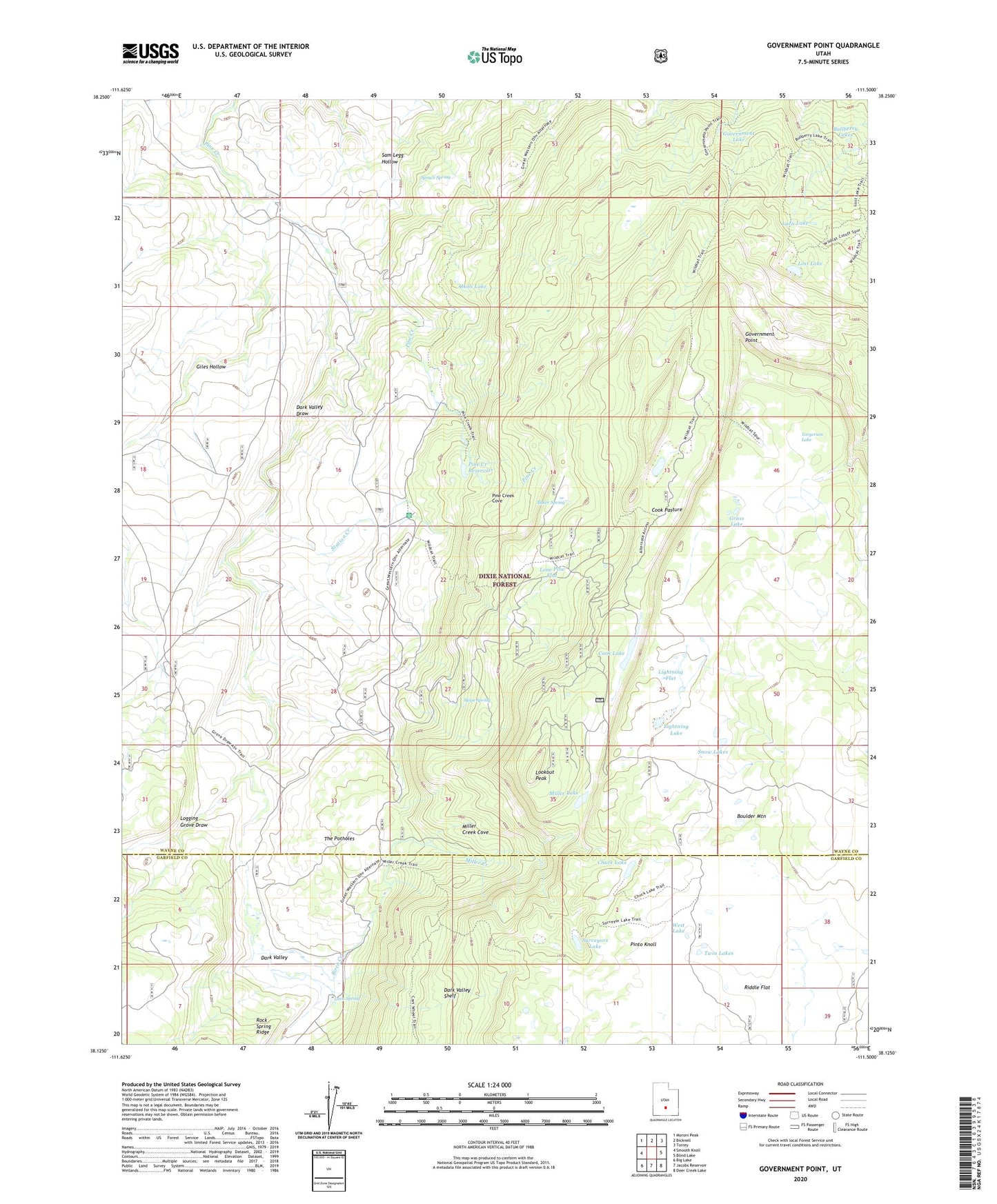
2020 topographic map quadrangle Government Point in the state of Utah. Scale: 1:24000. Based on the newly updated USGS 7.5' US Topo map series, this map is in the following counties: Wayne, Garfield. The map contains contour data, water features, and other items you are used to seeing on USGS maps, but also has updated roads and other features. This is the next generation of topographic maps. Printed on high-quality waterproof paper with UV fade-resistant inks.
Quads adjacent to this one:
West: Smooth Knoll
Northwest: Moroni Peak
North: Bicknell
Northeast: Torrey
East: Blind Lake
Southeast: Deer Creek Lake
South: Jacobs Reservoir
Southwest: Big Lake
Contains the following named places: Alkali Lake, Aquarius Guard Station, Aquarius Trail, Baker Spring, Birch Creek, Bluebell Knoll, Boulder Mountain, Bullberry Lakes, Chuck Lake, Cook Lake, Cook Pasture, Dark Valley, Dark Valley Draw, Giles Hollow, Government Lake, Government Point, Grass Lake, Lava Lake, Lava Spring, Lightning Flat, Lightning Lake, Logging Grove, Logging Grove Draw, Lone Pine Flat, Lookout Peak, Lost Lake, Mill Field, Miller Creek, Miller Creek Cove, Miller Lake, Peterson Grove, Pine Creek Cove, Pine Creek Reservoir, Pine Creek Reservoir Dam, Pinto Knoll, Pollywog Lake Trail, Slope Spring, Snow Lakes, Spruce Spring, Station Creek, Surveyors Lake, The Potholes, Torgerson Lake, Twin Lakes, West Lake