MyTopo
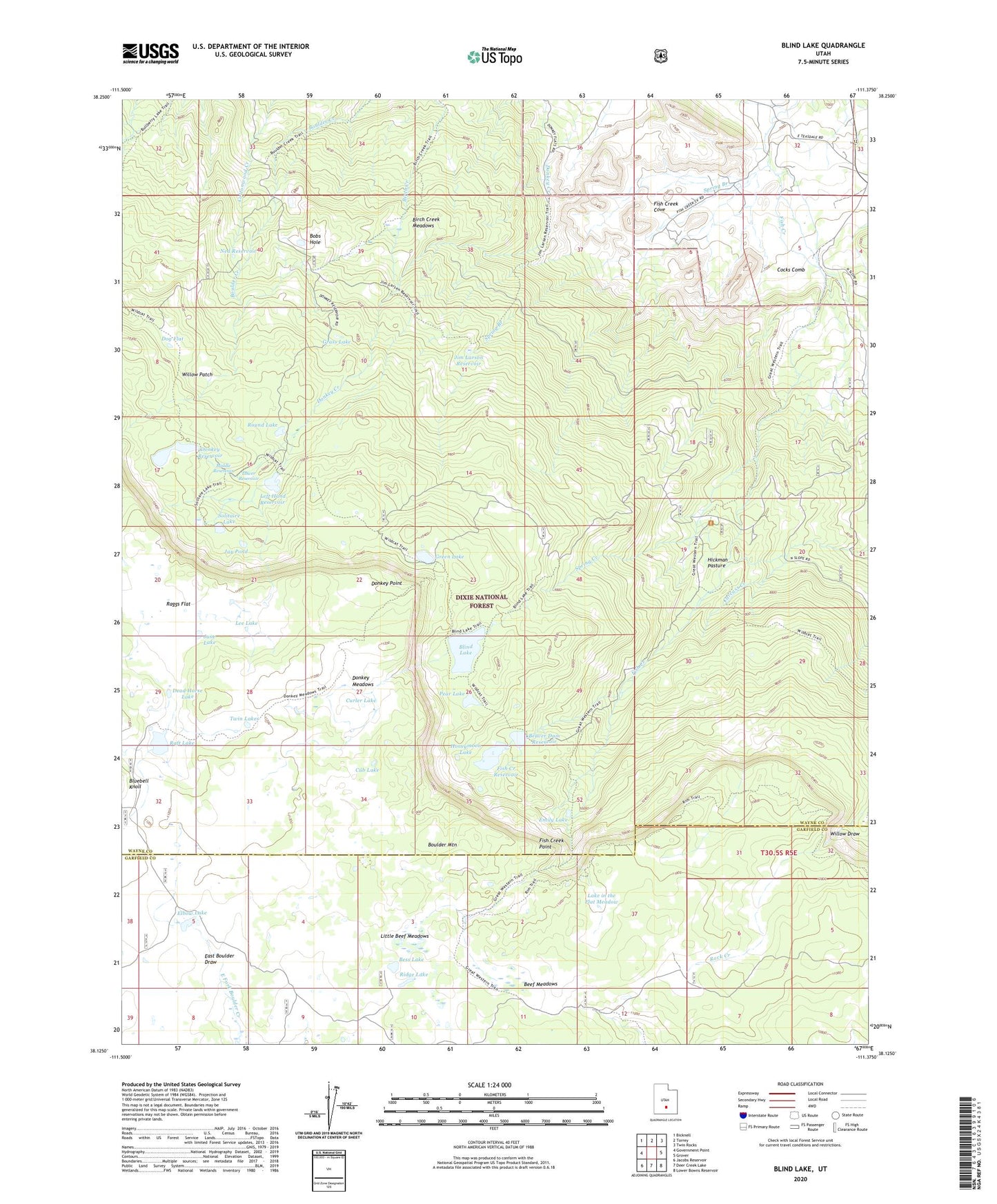
Blind Lake Utah US Topo Map
Couldn't load pickup availability
Also explore the Blind Lake Forest Service Topo of this same quad for updated USFS data
2023 topographic map quadrangle Blind Lake in the state of Utah. Scale: 1:24000. Based on the newly updated USGS 7.5' US Topo map series, this map is in the following counties: Wayne, Garfield. The map contains contour data, water features, and other items you are used to seeing on USGS maps, but also has updated roads and other features. This is the next generation of topographic maps. Printed on high-quality waterproof paper with UV fade-resistant inks.
Quads adjacent to this one:
West: Government Point
Northwest: Bicknell
North: Torrey
Northeast: Twin Rocks
East: Grover
Southeast: Lower Bowns Reservoir
South: Deer Creek Lake
Southwest: Jacobs Reservoir
This map covers the same area as the classic USGS quad with code o38111b4.
Contains the following named places: Beaver Dam Reservoir, Beef Meadows, Bess Lake, Birch Creek Meadows, Blind Lake, Bobs Hole, Cocks Comb, Cub Lake, Curler Lake, Dead Horse Lake, Dog Flat, Donkey Dam, Donkey Meadows, Donkey Point, Donkey Reservoir, Elbow Lake, Emily Lake, Fish Creek Cove, Fish Creek Dam, Fish Creek Point, Fish Creek Reservoir, Grass Lake, Green Lake, Hickman Pasture, Honeymoon Lake, Jane Lake, Jay Pond, Jim Larson Reservoir, Lake in the Flat Meadow, Lee Lake, Left Hand Fork of Donkey Creek Dam, Left Hand Reservoir, Little Beef Meadows, Lower Donkey Dam, Lower Donkey Reservoir, Lower Reservoir, Middle Donkey Dam, Middle Reservoir, Ned Reservoir, Pear Lake, Raft Lake, Raggs Flat, Ridge Lake, Round Lake, Solitaire Lake, Spring Branch, Spring Creek, Twin Lakes, Willow Draw, Willow Patch