MyTopo
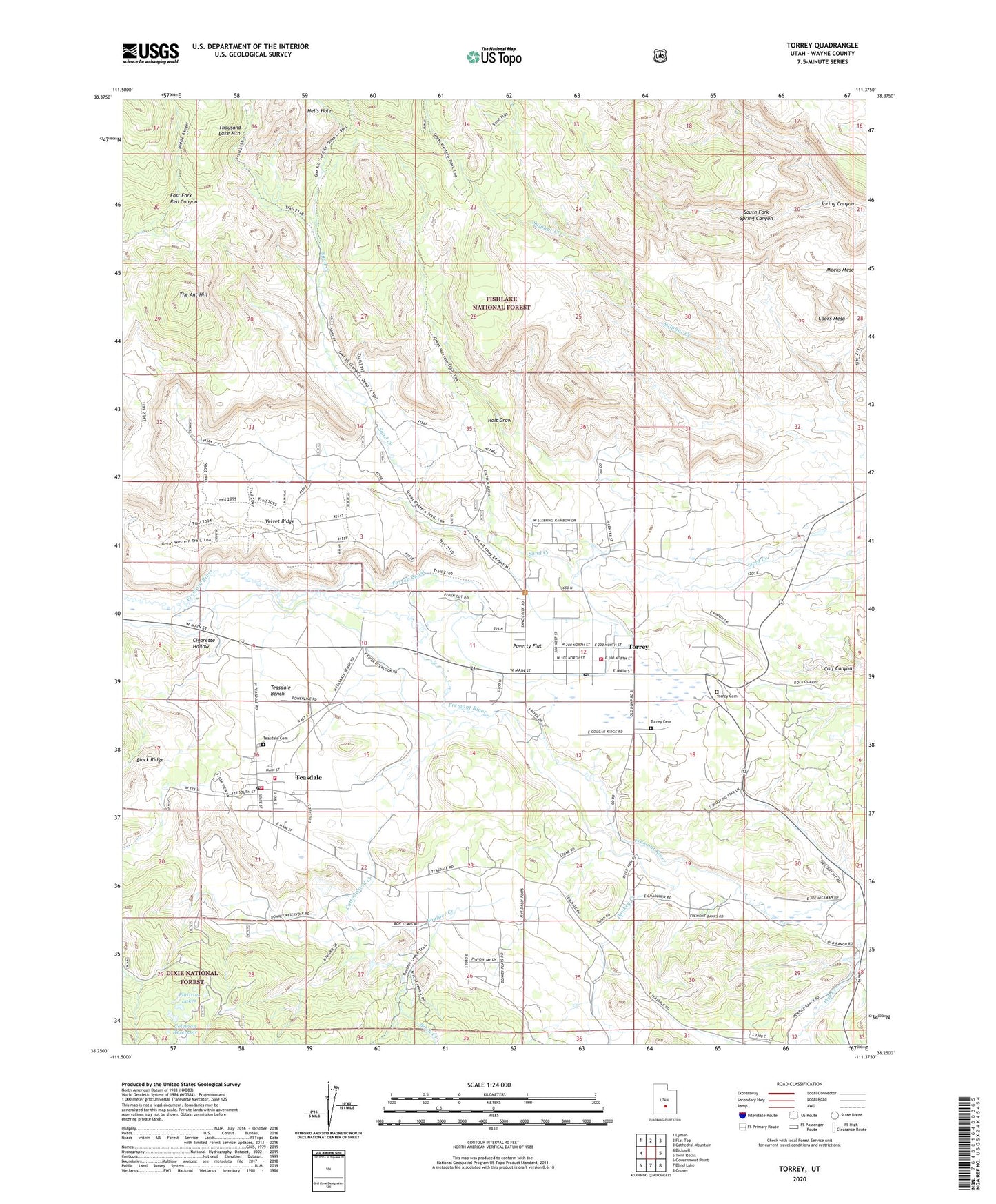
Torrey Utah US Topo Map
Couldn't load pickup availability
Also explore the Torrey Forest Service Topo of this same quad for updated USFS data
2023 topographic map quadrangle Torrey in the state of Utah. Scale: 1:24000. Based on the newly updated USGS 7.5' US Topo map series, this map is in the following counties: Wayne. The map contains contour data, water features, and other items you are used to seeing on USGS maps, but also has updated roads and other features. This is the next generation of topographic maps. Printed on high-quality waterproof paper with UV fade-resistant inks.
Quads adjacent to this one:
West: Bicknell
Northwest: Lyman
North: Flat Top
Northeast: Cathedral Mountain
East: Twin Rocks
Southeast: Grover
South: Blind Lake
Southwest: Government Point
This map covers the same area as the classic USGS quad with code o38111c4.
Contains the following named places: Birch Creek, Boulder Creek, Cigarette Hollow, Coleman Reservoir, Cooks Mesa, Cottonwood Creek, Donkey Creek, Flatiron Lakes, Hells Hole, Meeks Mesa, Poverty Flat, Red Cliff Oasis, Rim Rock Resort Ranch, South Fork Spring Canyon, Stair Trail, Teasdale, Teasdale Bench, Teasdale Cemetery, Teasdale Census Designated Place, Teasdale District Ranger Station, Teasdale Fire Department, Teasdale Post Office, The Ant Hill, The Church of Jesus Christ of Latter Day Saints, Torrey, Torrey Airport, Torrey Canal, Torrey Cemetery, Torrey Fire Department, Torrey Post Office, Town of Torrey, United States Forest Service Fire Station Teasdale Work Station, Velvet Ridge