MyTopo
Harts Point South Utah US Topo Map
Couldn't load pickup availability
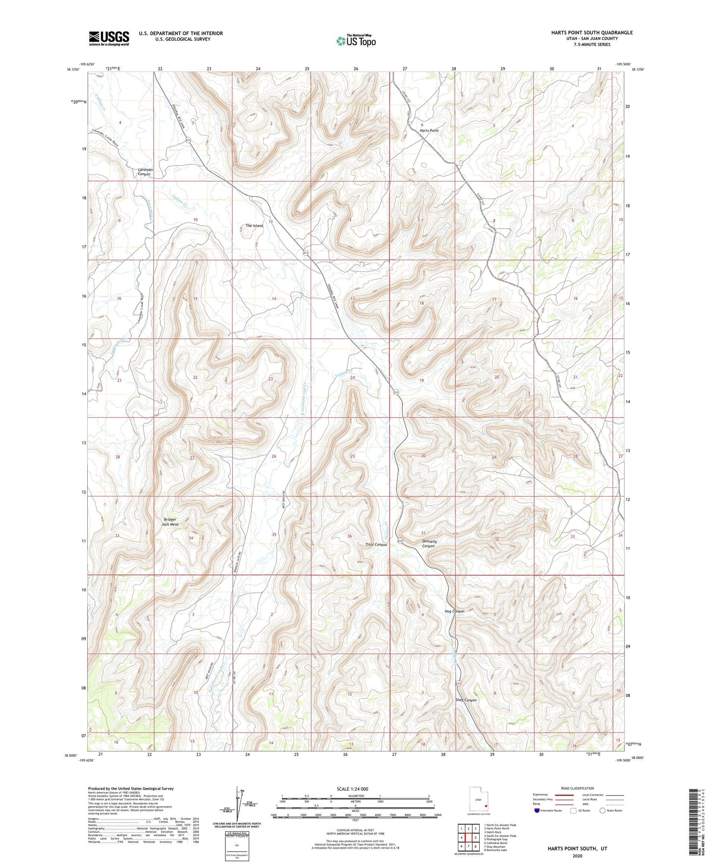
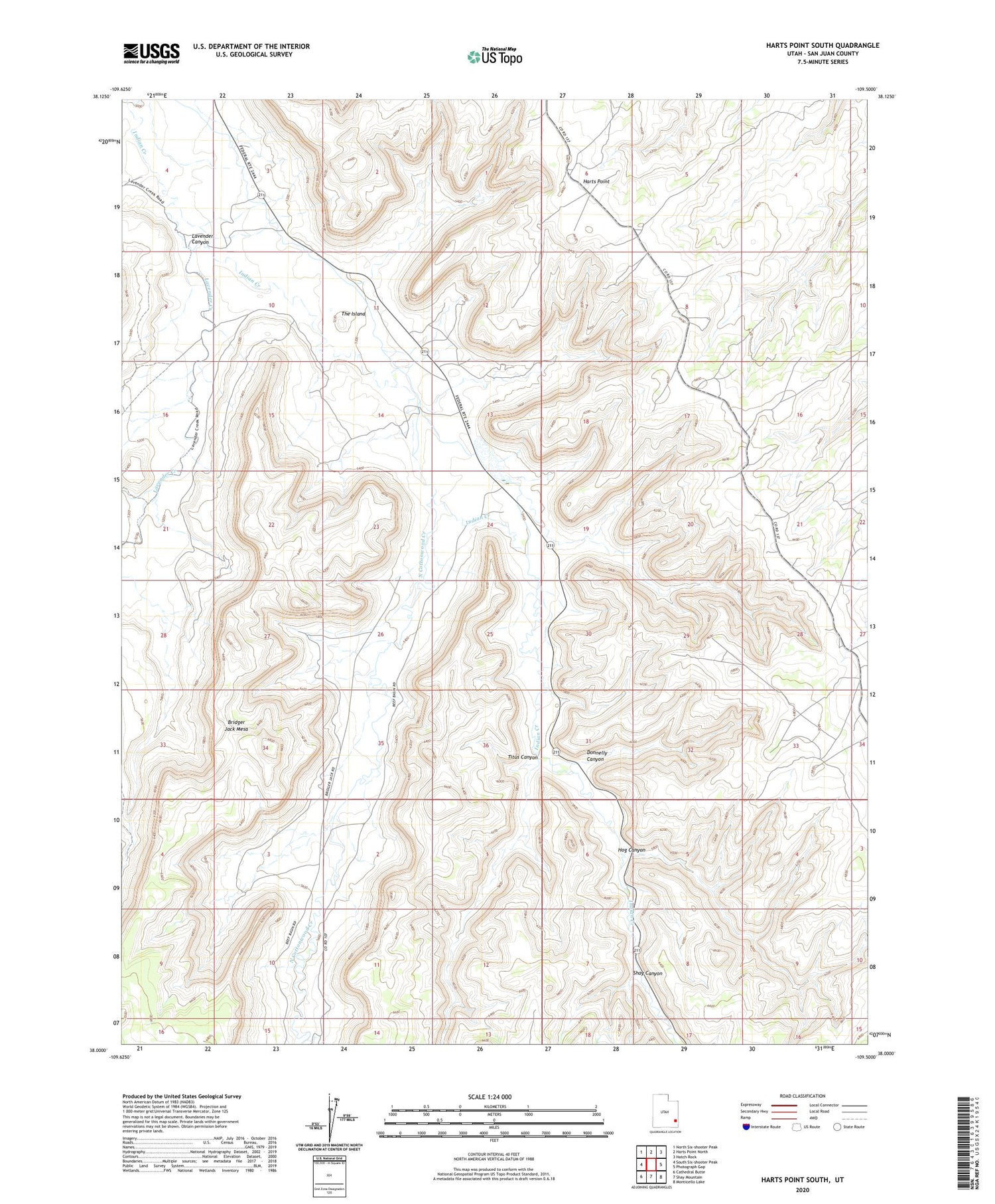
2020 topographic map quadrangle Harts Point South in the state of Utah. Scale: 1:24000. Based on the newly updated USGS 7.5' US Topo map series, this map is in the following counties: San Juan. The map contains contour data, water features, and other items you are used to seeing on USGS maps, but also has updated roads and other features. This is the next generation of topographic maps. Printed on high-quality waterproof paper with UV fade-resistant inks.
Quads adjacent to this one:
West: South Six-shooter Peak
Northwest: North Six-shooter Peak
North: Harts Point North
Northeast: Hatch Rock
East: Photograph Gap
Southeast: Monticello Lake
South: Shay Mountain
Southwest: Cathedral Butte
Contains the following named places: Bridger Jack Mesa Outstanding Natural Area, Donnelly Canyon, Dugout Dam, Dugout Ranch, Dugout Reservoir, Hog Canyon, Lavender Canyon, Lavender Creek, North Cottonwood Creek, Shay Canyon, The Island, Titus Canyon