MyTopo
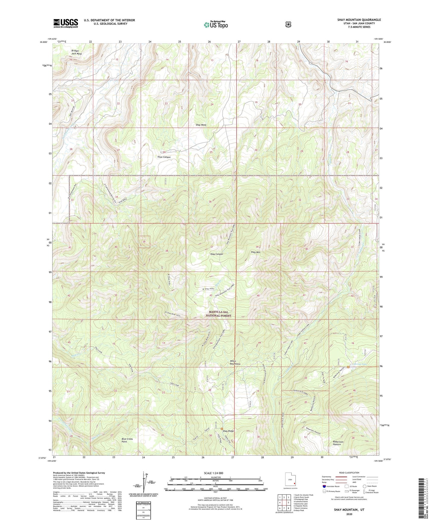
Shay Mountain Utah US Topo Map
Couldn't load pickup availability
Also explore the Shay Mountain Forest Service Topo of this same quad for updated USFS data
2023 topographic map quadrangle Shay Mountain in the state of Utah. Scale: 1:24000. Based on the newly updated USGS 7.5' US Topo map series, this map is in the following counties: San Juan. The map contains contour data, water features, and other items you are used to seeing on USGS maps, but also has updated roads and other features. This is the next generation of topographic maps. Printed on high-quality waterproof paper with UV fade-resistant inks.
Quads adjacent to this one:
West: Cathedral Butte
Northwest: South Six-shooter Peak
North: Harts Point South
Northeast: Photograph Gap
East: Monticello Lake
Southeast: Abajo Peak
South: Mount Linnaeus
Southwest: Chippean Rocks
This map covers the same area as the classic USGS quad with code o37109h5.
Contains the following named places: Blue Creek, Blue Creek Point, Kelly Ranch, Manti-La Sal National Forest - La Sal Division, Newspaper Rock, Newspaper Rock Campground, Newspaper Rock State Historical Monument, Robertson Pasture, Shay Mesa, Shay Mountain, Spring Lake, Spring Lake Dam, Wilson Ranch, ZIP Code: 84535