MyTopo
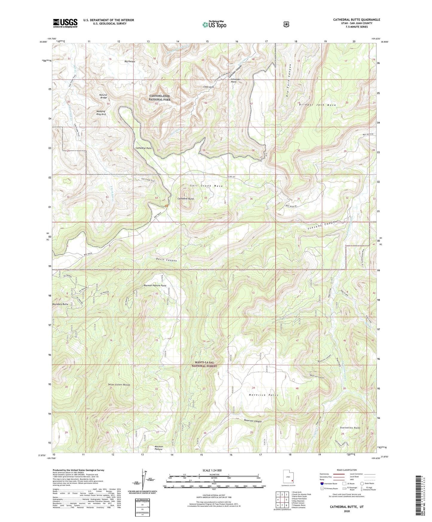
Cathedral Butte Utah US Topo Map
Couldn't load pickup availability
Also explore the Cathedral Butte Forest Service Topo of this same quad for updated USFS data
2023 topographic map quadrangle Cathedral Butte in the state of Utah. Scale: 1:24000. Based on the newly updated USGS 7.5' US Topo map series, this map is in the following counties: San Juan. The map contains contour data, water features, and other items you are used to seeing on USGS maps, but also has updated roads and other features. This is the next generation of topographic maps. Printed on high-quality waterproof paper with UV fade-resistant inks.
Quads adjacent to this one:
West: House Park Butte
Northwest: Druid Arch
North: South Six-shooter Peak
Northeast: Harts Point South
East: Shay Mountain
Southeast: Mount Linnaeus
South: Chippean Rocks
Southwest: Poison Canyon
This map covers the same area as the classic USGS quad with code o37109h6.
Contains the following named places: Betty Mine, Big Pocket, Boundary Butte, Bridger Jack, Bridger Jack Mesa, Cathedral Butte, Cathedral Point, Cleft Arch, Davis Canyon, East Fork Salt Creek, Hop Creek, Kirk Cabin, Lavender Point, Mormon Pasture Point, Natural Bridge, North Cottonwood Guard Station, Reservoir Canyon, Salt Creek Mesa, Stevens Canyon, Vega Creek, Wedding Ring Arch