MyTopo
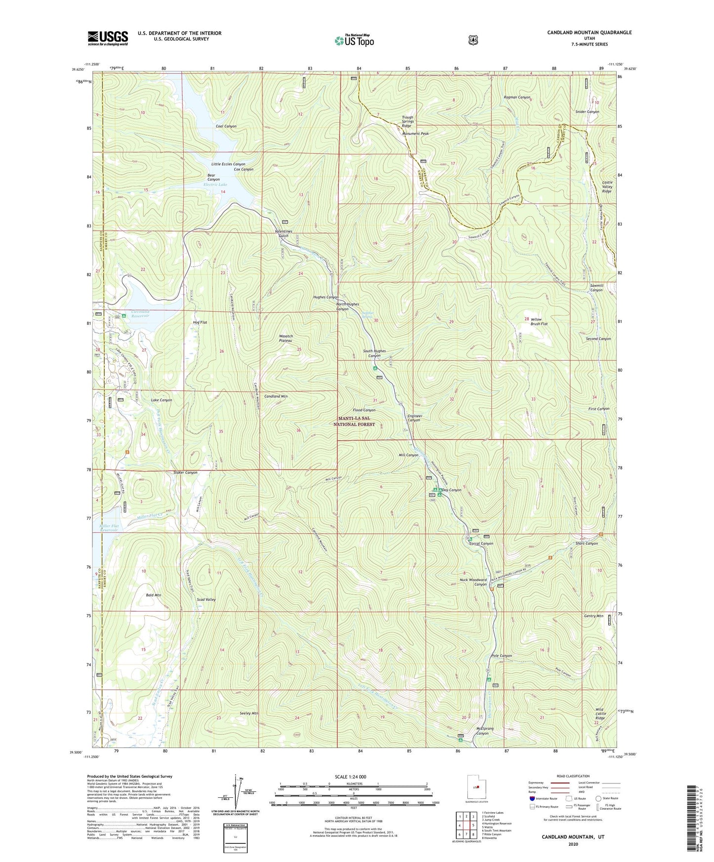
Candland Mountain Utah US Topo Map
Couldn't load pickup availability
Also explore the Candland Mountain Forest Service Topo of this same quad for updated USFS data
2023 topographic map quadrangle Candland Mountain in the state of Utah. Scale: 1:24000. Based on the newly updated USGS 7.5' US Topo map series, this map is in the following counties: Emery, Carbon, Sanpete. The map contains contour data, water features, and other items you are used to seeing on USGS maps, but also has updated roads and other features. This is the next generation of topographic maps. Printed on high-quality waterproof paper with UV fade-resistant inks.
Quads adjacent to this one:
West: Huntington Reservoir
Northwest: Fairview Lakes
North: Scofield
Northeast: Jump Creek
East: Wattis
Southeast: Hiawatha
South: Rilda Canyon
Southwest: South Tent Mountain
This map covers the same area as the classic USGS quad with code o39111e2.
Contains the following named places: Bald Mountain, Bear Canyon, Candland Mountain, Cleveland Dam, Cleveland Reservoir, Coal Canyon, Corral Canyon, Cox Canyon, Day Canyon, Electric Lake, Electric Lake Dam, Engineer Canyon, Fireside Mine, First Canyon, Flood Canyon, Forks of Huntington Campground, Hog Flat, Hughes Canyon, Huntington Mine, Lake Canyon, Little Eccles Canyon, McElprang Canyon, Mill Canyon, Miller Flat Creek, Miller Flat Dam, Miller Flat Reservoir, Monument Peak, North Hughes Canyon, Nuck Woodward Canyon, Old Fireside Mine, Old Folks Flat Campground, Old Larsen Mine, Pole Canyon, Ragman Canyon, Sawmill Canyon, Scad Valley, Scad Valley Creek, Second Canyon, Seeley Mountain, Short Canyon, South Hughes Canyon, Staker Canyon, Stuart Guard Station, Sulphur Spring, Trough Springs Ridge, Valentines Gulch, Yellow Brush Flat